|
search place name
|
||
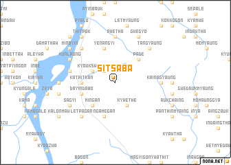
Sitsaba (Myanmar)Sitsaba is a town in Myanmar. An overview map of the region around Sitsaba is displayed below.
regional and 3d topo map of Sitsaba, Myanmar ::
Sitsaba airports ::
The nearest airport is SNW - Thandwe, located 119.1 km south west of Sitsaba.
Other airports nearby include KYP - Kyaukpyu (183.0 km west), HEH - Heho (247.5 km north east), Nearby towns ::
Myingabaing (2.6km north west) //
Kyoukswegyo (4.0km north west) //
Kywethe (4.1km south east) //
Mingan (5.1km south west) //
Pade (5.1km north east) //
Kathitkan (5.3km west) //
Yenangyi (5.8km north) //
Ngamègan (5.8km south) //
Dayindabo (5.6km west) //
Pwetha (7.4km north) //
Kainggyaung (7.0km east) //
Myinuashe (7.2km west) //
Ngapyin (7.2km west) //
Letpagan (7.7km south west) //
Pyinbinhla (7.6km north west) //
Tangyaung (7.6km north east) //
Kunlaung (7.9km north west) //
Gwegyo (8.2km north east) //
Sagyi (7.9km south west) //
Thitpok (9.1km north west) //
Minbyin (8.9km north west) //
Pato (10.2km north west) //
[all distances 'as the bird flies' and approximate]  Places with similar names to Sitsaba, Myanmar ::
// Sidi es Sabbih (TN)
// Sitassaba (ML)
Disclaimer :: Information on this page comes without warranty of any kind |
||
|
Where is Sitsaba? Elevation and coordinates ::
Latitude (lat): 19°4'0"N Longitude (lon): 95°14'0"E
Elevation (approx.): 87m (map arrows pan, magnifying glasses zoom) |
||
|
Visiting Sitsaba? Hotel/Accommodation ::
Book a hotel in Sitsaba Travel Guide ::
Buy a travel guide for Myanmar rental cars ::
car rental offers GPS waypoint ::
download a GPX waypoint (PoI) of Sitsaba for your GPS receiver
|
||