|
search place name
|
||
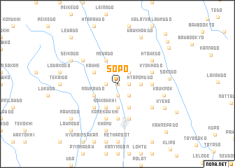
Sopo (Kayin, Myanmar)Sopo is a town in the Kayin region of Myanmar. An overview map of the region around Sopo is displayed below.
regional and 3d topo map of Sopo, Myanmar ::
Sopo airports ::
The nearest airport is RGN - Yangon Intl, located 192.3 km south west of Sopo.
Nearby towns ::
Pantun (0.0km north) //
Kho-u-do (1.8km west) //
Dweiloko (1.8km west) //
Wapude (1.9km south) //
Bawthikhi (1.8km east) //
Bawthilaw (2.6km north east) //
Tohpopado (2.6km south east) //
Pawnet (3.7km south) //
Htapomudo (3.5km east) //
Kawhe (4.0km north west) //
Mewado (4.1km north west) //
Mawkawdo (4.0km south west) //
Saikawkhi (4.1km south west) //
Nithuta (4.1km south east) //
Minnannwè (5.1km south west) //
Nanta (5.3km east) //
Thayutta (5.6km south) //
Kyokhodo (5.6km east) //
Kanekawkhi (5.8km south) //
Papun (5.8km south) //
Moseido (6.5km north west) //
Htowedo (6.5km north east) //
Teresa Ywa (6.5km south east) //
Khamu (7.6km south) //
Kaukpok (7.3km east) //
Seikodo (8.0km north west) //
Wawkhawdo (8.2km north east) //
Sokodo (8.0km east) //
Kyehe (8.1km south east) //
[all distances 'as the bird flies' and approximate] 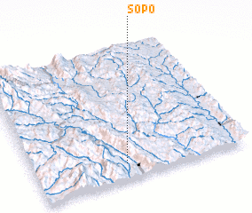 Places with similar names to Sopo, Myanmar ::
Disclaimer :: Information on this page comes without warranty of any kind |
||
|
Where is Sopo? Elevation and coordinates ::
Latitude (lat): 18°7'0"N Longitude (lon): 97°26'0"E
Elevation (approx.): 104m (map arrows pan, magnifying glasses zoom) |
||
|
Visiting Sopo? Hotel/Accommodation ::
Book a hotel in Sopo Travel Guide ::
Buy a travel guide for Myanmar rental cars ::
car rental offers GPS waypoint ::
download a GPX waypoint (PoI) of Sopo for your GPS receiver
|
||