|
search place name
|
||
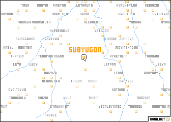
Subyugon (Mandalay, Myanmar)Subyugon is a town in the Mandalay region of Myanmar. An overview map of the region around Subyugon is displayed below.
regional and 3d topo map of Subyugon, Myanmar ::
Subyugon airports ::
The nearest airport is MDL - Mandalay Intl, located 97.5 km north east of Subyugon.
Other airports nearby include HEH - Heho (151.7 km east), KYP - Kyaukpyu (261.3 km south west), Nearby towns ::
Myingyangon (1.9km south) //
Tanchaukpin (1.9km south) //
Nagabo (3.9km north east) //
Myinthadaung (5.1km north west) //
Letpan (5.5km east) //
Didok (5.8km south) //
Thigon (5.8km south) //
Thangyigon (6.4km south west) //
Ye-tagon (6.5km north east) //
Ywatha (6.4km north west) //
Kozin (6.4km north east) //
Kyibinde (6.4km north east) //
Kywetalin (6.9km east) //
Tebintaunggon (6.9km west) //
Hlebwegon (7.6km north) //
Hlebeingwe (7.6km north west) //
Lebin (7.9km south east) //
Magyizu (7.9km south west) //
Thanat-aing (8.2km north east) //
Kabatywa (7.8km north west) //
Taungyo-zalok (8.9km north east) //
Hlaingtha (8.9km south west) //
Taunglalin (9.0km north east) //
Kataing (10.1km south east) //
[all distances 'as the bird flies' and approximate] 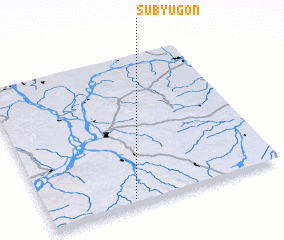 Places with similar names to Subyugon, Myanmar ::
Disclaimer :: Information on this page comes without warranty of any kind |
||
|
Where is Subyugon? Elevation and coordinates ::
Latitude (lat): 21°2'0"N Longitude (lon): 95°22'0"E
Elevation (approx.): 276m (map arrows pan, magnifying glasses zoom) |
||
|
Visiting Subyugon? Hotel/Accommodation ::
Book a hotel in Subyugon Travel Guide ::
Buy a travel guide for Myanmar rental cars ::
car rental offers GPS waypoint ::
download a GPX waypoint (PoI) of Subyugon for your GPS receiver
|
||