|
search place name
|
||
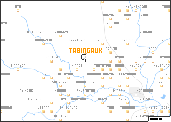
Tabingauk (Myanmar)Tabingauk is a town in Myanmar. An overview map of the region around Tabingauk is displayed below.
regional and 3d topo map of Tabingauk, Myanmar ::
Tabingauk airports ::
The nearest airport is HEH - Heho, located 199.3 km north of Tabingauk.
Nearby towns ::
Kanzaya (1.9km north) //
Nebugon (1.9km north) //
Kinnge (2.6km south west) //
Hinyemya (2.6km south east) //
Zayatkwin (4.1km north west) //
Bokadaw (4.1km south east) //
Thayetpin (4.0km south east) //
Kyu-in (5.1km south west) //
Zayatkyigon (5.1km north east) //
Myaungyochaung (5.1km south east) //
Kyungon (5.1km north east) //
Htangon (5.1km south east) //
Hteingon (5.3km east) //
Kanbaukkyi (5.6km south) //
Pyezo-in (5.8km south) //
Myinsakhwet (5.8km south) //
Indaing (5.6km east) //
Mweyo (5.8km south) //
Sudat (5.6km east) //
Kanyingyaung (5.6km west) //
Magyigon (6.4km south east) //
Inde (6.4km south east) //
Thayagon (6.6km south east) //
Konthā (7.0km west) //
Pabewa (7.4km south) //
Shweguywa (7.4km south) //
Hnasaungbyaing (7.0km east) //
Kya-in (7.0km east) //
Shanzu (7.6km south) //
[all distances 'as the bird flies' and approximate] 
Disclaimer :: Information on this page comes without warranty of any kind |
||
|
Where is Tabingauk? Elevation and coordinates ::
Latitude (lat): 19°0'0"N Longitude (lon): 96°20'0"E
Elevation (approx.): 57m (map arrows pan, magnifying glasses zoom) |
||
|
Visiting Tabingauk? Hotel/Accommodation ::
Book a hotel in Tabingauk Travel Guide ::
Buy a travel guide for Myanmar rental cars ::
car rental offers GPS waypoint ::
download a GPX waypoint (PoI) of Tabingauk for your GPS receiver
|
||