|
search place name
|
||
Tandawma (Myanmar)Tandawma is a town in Myanmar. An overview map of the region around Tandawma is displayed below.
regional and 3d topo map of Tandawma, Myanmar ::

Tandawma airports ::
The nearest airport is MDL - Mandalay Intl, located 106.9 km east of Tandawma.
Other airports nearby include HEH - Heho (223.9 km south east), Nearby towns ::
Pyathi (0.0km north) //
Ywathit (1.9km north) //
Leda (2.5km north west) //
Taunggaing (2.5km south west) //
Letyetma (4.1km south west) //
Ywashe (3.9km south west) //
Shangaing (5.1km north east) //
Paungdè (5.1km south east) //
Pyintha (5.1km south west) //
Kyadet (5.8km north) //
Pazwa (7.1km east) //
Taungbo (7.6km south) //
Taya (7.6km north east) //
Zebani (7.6km north west) //
Kandwin (7.6km north east) //
Alôn (8.2km south west) //
[all distances 'as the bird flies' and approximate] 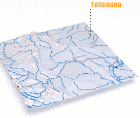 Places with similar names to Tandawma, Myanmar ::
// Taawndām (MM)
// Tandawma (MM)
// Tanah Hitam (MY)
// Tanah Hitam (MY)
// Deh Nadām (IR)
// Dendema (ET)
// Dendema (ET)
// Dendema (ET)
// Tintémou (BJ)
// Dindoum (TD)
Disclaimer :: Information on this page comes without warranty of any kind |
||
|
Where is Tandawma? Elevation and coordinates ::
Latitude (lat): 21°48'0"N Longitude (lon): 94°57'0"E
Elevation (approx.): 143m (map arrows pan, magnifying glasses zoom) |
||
|
Visiting Tandawma? Hotel/Accommodation ::
Book a hotel in Tandawma Travel Guide ::
Buy a travel guide for Myanmar rental cars ::
car rental offers GPS waypoint ::
download a GPX waypoint (PoI) of Tandawma for your GPS receiver
|
||