|
search place name
|
||
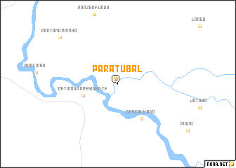
Paratubal (Mato Grosso, Brazil)Paratubal is a town in the Mato Grosso region of Brazil. An overview map of the region around Paratubal is displayed below.
regional and 3d topo map of Paratubal, Brazil ::
Paratubal airports ::
The nearest airport is CGB - Cuiaba Marechal Rondon, located 208.1 km north east of Paratubal.
Nearby towns ::
Retiro do Presidente (5.6km west) //
Descalvado (6.6km south east) //
[all distances 'as the bird flies' and approximate] 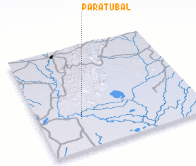 Places with similar names to Paratubal, Brazil ::
// Portobelo (PA)
// Portobello (ZA)
// Portobello (NZ)
// Portobello (US)
// Porta Bello (US)
// Porto Bello (CO)
// Portobelo (CO)
// Puerto Balao (EC)
// Port Bell (UG)
// Puerto Bello (VE)
Disclaimer :: Information on this page comes without warranty of any kind |
||
|
Where is Paratubal? Elevation and coordinates ::
Latitude (lat): 16°42'0"S Longitude (lon): 57°44'0"W
Elevation (approx.): 109m (map arrows pan, magnifying glasses zoom) |
||
|
Visiting Paratubal? Hotel/Accommodation ::
Book a hotel in Paratubal Travel Guide ::
Buy a travel guide for Brazil rental cars ::
car rental offers GPS waypoint ::
download a GPX waypoint (PoI) of Paratubal for your GPS receiver
|
||