|
search place name
|
||
Pintadas (Piauí, Brazil)Pintadas is a town in the Piauí region of Brazil. An overview map of the region around Pintadas is displayed below.
regional and 3d topo map of Pintadas, Brazil ::

Pintadas airports ::
The nearest airport is THE - Teresina Senador Petronio Portella, located 162.2 km south of Pintadas.
Other airports nearby include SLZ - Sao Luis Marechal Cunha Machado Intl (231.4 km north west), Nearby towns ::
Contendas (2.7km south west) //
Jenipapeiro (3.1km west) //
Massapê (5.0km south) //
Anajá (5.1km north) //
Maracujá (5.6km south) //
Malhada (5.7km south east) //
Banguelo (5.8km west) //
Vigilância (5.9km north east) //
Negro (5.9km north west) //
Sítio (6.0km west) //
Bom Lugar (6.2km east) //
Pinto (7.3km north west) //
Cipó (7.3km west) //
Pedra Miúda (7.6km south) //
Chorão (8.3km south west) //
Tabaqueiro (8.3km south) //
Mocambo (8.6km south west) //
Enjeitado (8.7km south) //
Lagoinha (8.8km south east) //
Barrocão (9.0km south west) //
Imburana (9.1km south west) //
Boi Morto (9.1km south east) //
Irapoá (9.2km north east) //
Chapada do Barrocão (9.7km south west) //
Urucus (11.7km north west) //
[all distances 'as the bird flies' and approximate] 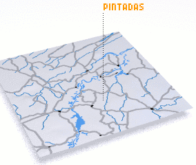 Places with similar names to Pintadas, Brazil ::
// Pintadas (BR)
// Penedo da Sé (PT)
// Pintados (CL)
// Pintadas (BR)
// Pontedassio (IT)
// Pont-dʼAisy (FR)
// Ponta Doce (GW)
// Ponta Doce (GW)
Disclaimer :: Information on this page comes without warranty of any kind |
||
|
Where is Pintadas? Elevation and coordinates ::
Latitude (lat): 3°38'41"S Longitude (lon): 42°26'20"W
Elevation (approx.): 93m (map arrows pan, magnifying glasses zoom) |
||
|
Visiting Pintadas? Hotel/Accommodation ::
Book a hotel in Pintadas Travel Guide ::
Buy a travel guide for Brazil rental cars ::
car rental offers GPS waypoint ::
download a GPX waypoint (PoI) of Pintadas for your GPS receiver
|
||