|
search place name
|
||
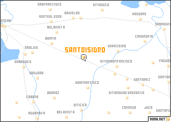
Santo Isidro (Rio Grande do Norte, Brazil)Santo Isidro is a town in the Rio Grande do Norte region of Brazil. An overview map of the region around Santo Isidro is displayed below.
regional and 3d topo map of Santo Isidro, Brazil ::
Santo Isidro airports ::
The nearest airport is NAT - Natal Augusto Severo, located 152.8 km south east of Santo Isidro.
Other airports nearby include JPA - Joao Pessoa Presidente Castro Pinto (269.7 km south east), Nearby towns ::
São Francisco (5.9km south) //
Sítio São Francisco (6.9km east) //
Vitoria (7.0km south east) //
Umarizeiro (7.4km east) //
Bonfim (8.3km north west) //
Bela Vista (8.9km north west) //
Boa Paz (10.6km south west) //
Monte Alegre (11.5km north west) //
[all distances 'as the bird flies' and approximate] 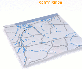 Places with similar names to Santo Isidro, Brazil ::
// Santo Esidro (BR)
// Santo Isidoro (BR)
// San Desiderio (IT)
// Santo Izidoro (PT)
// Santo Izidro (PT)
// Saint Isidore (ZA)
// Saint-Isidore (ML)
// Saint-Satur (FR)
// SantʼIsidoro (IT)
// Saint-Astier (FR)
Disclaimer :: Information on this page comes without warranty of any kind |
||
|
Where is Santo Isidro? Elevation and coordinates ::
Latitude (lat): 5°13'7"S Longitude (lon): 36°26'26"W
Elevation (approx.): 40m (map arrows pan, magnifying glasses zoom) |
||
|
Visiting Santo Isidro? Hotel/Accommodation ::
Book a hotel in Santo Isidro Travel Guide ::
Buy a travel guide for Brazil rental cars ::
car rental offers GPS waypoint ::
download a GPX waypoint (PoI) of Santo Isidro for your GPS receiver
|
||