|
search place name
|
||
Bāt Khēl (Lowgar, Afghanistan)Bāt Khēl is a town in the Lowgar region of Afghanistan. An overview map of the region around Bāt Khēl is displayed below.
regional and 3d topo map of Bāt Khēl, Afghanistan ::

Bāt Khēl airports ::
The nearest airport is KBL - Kabul Intl, located 36.4 km north of Bāt Khēl.
Other airports nearby include JAA - Jalalabad (105.7 km east), Nearby towns ::
Bāwo Khēl (7.7km south west) //
Gol Darreh (9.4km north east) //
Chakarī (11.2km north east) //
[all distances 'as the bird flies' and approximate] 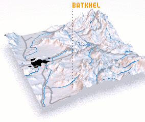 Places with similar names to Bāt Khēl, Afghanistan ::
// Bīd Khal (IR)
// Bīdkholah (IR)
// Bātikhāli (BD)
// Batkholu (IN)
// Bada Khel (PK)
// Badi Khel (PK)
// Bat Khela (PK)
// Badī‘ Kheyl (IR)
// Bodah Kheyl (AF)
Disclaimer :: Information on this page comes without warranty of any kind |
||
|
Where is Bāt Khēl? Elevation and coordinates ::
Latitude (lat): 34°15'44"N Longitude (lon): 69°21'44"E
Elevation (approx.): 2685m (map arrows pan, magnifying glasses zoom) |
||
|
Visiting Bāt Khēl? Hotel/Accommodation ::
Book a hotel in Bāt Khēl Travel Guide ::
Buy a travel guide for Afghanistan rental cars ::
car rental offers GPS waypoint ::
download a GPX waypoint (PoI) of Bāt Khēl for your GPS receiver
|
||