|
search place name
|
||
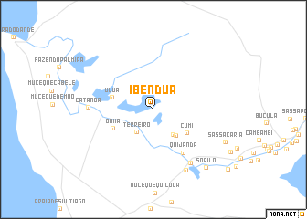
Ibéndua (Bengo, Angola)Ibéndua is a town in the Bengo region of Angola. An overview map of the region around Ibéndua is displayed below.
regional and 3d topo map of Ibéndua, Angola ::
Ibéndua airports ::
The nearest airport is LAD - Luanda 4 De Fevereiro, located 47.0 km south west of Ibéndua.
Other airports nearby include UGO - Uige (196.2 km north east), GXG - Negage (213.5 km north east), Nearby towns ::
Terreiro (3.4km south west) //
Terreiro (3.4km south west) //
Cabungo (3.9km south east) //
Quipetelo (4.1km south east) //
Cumi (4.9km south east) //
Úlua (5.2km west) //
Gama (5.4km south west) //
Quijanda (6.4km south east) //
Boa Vista (7.9km south east) //
Catanga (7.9km west) //
Porto Quipiri (8.3km south east) //
Sorilo (9.5km south east) //
Sassa Cária (9.6km south east) //
[all distances 'as the bird flies' and approximate] 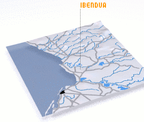 Places with similar names to Ibéndua, Angola ::
Disclaimer :: Information on this page comes without warranty of any kind |
||
|
Where is Ibéndua? Elevation and coordinates ::
Latitude (lat): 8°32'48"S Longitude (lon): 13°31'15"E
Elevation (approx.): 22m (map arrows pan, magnifying glasses zoom) |
||
|
Visiting Ibéndua? Hotel/Accommodation ::
Book a hotel in Ibéndua Travel Guide ::
Buy a travel guide for Angola rental cars ::
car rental offers GPS waypoint ::
download a GPX waypoint (PoI) of Ibéndua for your GPS receiver
|
||