|
search place name
|
||
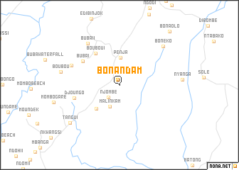
Bonandam (Littoral, Cameroon)Bonandam is a town in the Littoral region of Cameroon. An overview map of the region around Bonandam is displayed below.
regional and 3d topo map of Bonandam, Cameroon ::
Bonandam airports ::
The nearest airport is DLA - Douala, located 65.6 km south of Bonandam.
Other airports nearby include TKC - Tiko (66.5 km south west), BFX - Bafoussam (128.0 km north east), SSG - Malabo (142.5 km south west), CBQ - Calabar (153.7 km west), Nearby towns ::
Njombé (2.6km south west) //
Malinkam (3.8km south west) //
Penja (4.3km north) //
Mbome Ngwandang (5.2km south west) //
Boubou I (6.3km north west) //
Buba I (6.9km north west) //
Djoungo (7.3km west) //
Buba II (8.2km north west) //
Boubou II (8.2km west) //
Bonéko (9.2km north east) //
Tangui (9.8km south west) //
Bonaolo (11.5km north east) //
[all distances 'as the bird flies' and approximate] 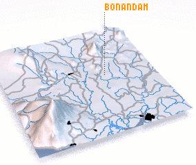 Places with similar names to Bonandam, Cameroon ::
// Ban Non Tum (TH)
// Ban Non Tum (TH)
// Ban Non Tum (TH)
// Ban Non Tum (TH)
// Ban Non Tum (TH)
// Ban Non U-dom (TH)
// Banantombo (GN)
// Banan Toumbo (GN)
// Banan Toumbo (GN)
// Ban Nôntoum (LA)
Disclaimer :: Information on this page comes without warranty of any kind |
||
|
Where is Bonandam? Elevation and coordinates ::
Latitude (lat): 4°35'52"N Longitude (lon): 9°40'49"E
Elevation (approx.): 117m (map arrows pan, magnifying glasses zoom) |
||
|
Visiting Bonandam? Hotel/Accommodation ::
Book a hotel in Bonandam Travel Guide ::
Buy a travel guide for Cameroon rental cars ::
car rental offers GPS waypoint ::
download a GPX waypoint (PoI) of Bonandam for your GPS receiver
|
||