|
search place name
|
||
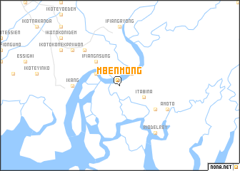
Mbenmong (Cameroon)Mbenmong is a town in Cameroon. An overview map of the region around Mbenmong is displayed below.
regional and 3d topo map of Mbenmong, Cameroon ::
Mbenmong airports ::
The nearest airport is CBQ - Calabar, located 34.1 km north west of Mbenmong.
Other airports nearby include TKC - Tiko (115.3 km south east), SSG - Malabo (116.2 km south), DLA - Douala (152.1 km south east), PHC - Port Hartcourt Port Harcourt Intl (184.6 km west), Nearby towns ::
Archibong (2.6km north east) //
Esuokon (4.1km north west) //
Itabina (4.1km south east) //
Ifiang Nsung (5.2km north west) //
Bateka (6.7km south east) //
Ikang (7.4km west) //
Ikot Inwang Akpo (7.8km north west) //
Amoto (8.3km south east) //
Ikot Edem Oku (9.2km north west) //
Awka Ikot Ene (9.2km north west) //
Rio-del-Rey (9.3km south east) //
[all distances 'as the bird flies' and approximate] 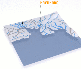 Places with similar names to Mbenmong, Cameroon ::
// Mān Ming (MM)
// Manmong (MM)
// Mān Mong (MM)
// Mān Mong (MM)
// Mān Namnōk (MM)
// Monmongou (BJ)
// Manuamang (TP)
// Manamang (PG)
// Manemong (PG)
// Minami-nagae (JP)
Disclaimer :: Information on this page comes without warranty of any kind |
||
|
Where is Mbenmong? Elevation and coordinates ::
Latitude (lat): 4°48'0"N Longitude (lon): 8°36'0"E
Elevation (approx.): 8m (map arrows pan, magnifying glasses zoom) |
||
|
Visiting Mbenmong? Hotel/Accommodation ::
Book a hotel in Mbenmong Travel Guide ::
Buy a travel guide for Cameroon rental cars ::
car rental offers GPS waypoint ::
download a GPX waypoint (PoI) of Mbenmong for your GPS receiver
|
||