|
search place name
|
||
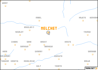
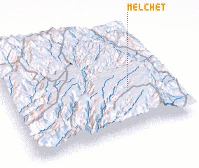
Melchʼet (Ethiopia)Melchʼet is a town in Ethiopia. An overview map of the region around Melchʼet is displayed below.
regional and 3d topo map of Melchʼet, Ethiopia ::
Melchʼet airports ::
The nearest airport is ADD - Addis Ababa Bole Intl, located 187.7 km south west of Melchʼet.
Other airports nearby include LLI - Lalibella (192.7 km north west), Nearby towns ::
 Places with similar names to Melchʼet, Ethiopia ::
// Malachite (US)
// Molisht (AL)
// Malashata (RU)
// Malyshata (RU)
// Malyye Chetai (RU)
// Malyye Shady (RU)
// Malyye Shidy (RU)
// Moleshet (ET)
// Malichedu (IN)
// Malshat (KZ)
Disclaimer :: Information on this page comes without warranty of any kind |
||
|
Where is Melchʼet? Elevation and coordinates ::
Latitude (lat): 10°24'0"N Longitude (lon): 39°44'0"E
Elevation (approx.): 3269m (map arrows pan, magnifying glasses zoom) |
||
|
Visiting Melchʼet? Hotel/Accommodation ::
Book a hotel in Melchʼet Travel Guide ::
Buy a travel guide for Ethiopia rental cars ::
car rental offers GPS waypoint ::
download a GPX waypoint (PoI) of Melchʼet for your GPS receiver
|
||