|
search place name
|
||
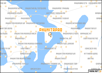
Phumĭ Tapaô (Svay Riĕng, Cambodia)Phumĭ Tapaô is a town in the Svay Riĕng region of Cambodia. An overview map of the region around Phumĭ Tapaô is displayed below.
regional and 3d topo map of Phumĭ Tapaô, Cambodia ::
Phumĭ Tapaô airports ::
The nearest airport is SGN - Ho Chi Minh City Tansonnhat Intl, located 69.6 km east of Phumĭ Tapaô.
Other airports nearby include PNH - Phnom-penh Phnom Penh Intl (144.8 km north west), Nearby towns ::
Phumĭ Prey Ph'av (0.0km north) //
Phumĭ Réam Choŭ (1.9km north) //
Phumĭ Prey Phniĕt (2.6km north west) //
Phumĭ Sâmlei (2.6km south west) //
Phumĭ Prey Mnoăs (4.1km south west) //
Phumĭ Prey Chheutéal (4.1km north east) //
Phumĭ Don Noy (4.1km south east) //
Phumĭ Dontôy (1) (4.1km south east) //
Phumĭ Chrés (5.2km south east) //
Phumĭ Svay (1) (5.6km south) //
Phumĭ Prey Praeus (5.8km west) //
Phumĭ Prey Pra (5.8km west) //
Phumĭ Kaôh Koŭ (5.8km east) //
Phumĭ Thlôk (5.8km east) //
Phumĭ Prey Stiĕng (1) (6.6km north west) //
Phumĭ Traôk (6.6km south west) //
Phumĭ Châmkar Léav (1) (6.6km north east) //
Phumĭ Prey Kôkir (6.6km north east) //
Phumĭ Tuŏl Spéan (6.6km south east) //
Phumĭ Prey Ângkŭnh (7.4km north) //
Phumĭ Pông Tœ̆k (7.3km east) //
Phumĭ Prey Thlôk (7.5km west) //
Chiphu (7.6km north) //
Vôtt Prey Ângkŭnh (7.6km north) //
Phumĭ Traôk (7.6km south) //
Khŭm Khsêtr (7.8km south west) //
Phumĭ Trâpeăng Krâpœ̆s (8.2km south west) //
Phumĭ Ângk Sala (8.3km north east) //
Phumĭ Srâmâr (9.2km south west) //
[all distances 'as the bird flies' and approximate] 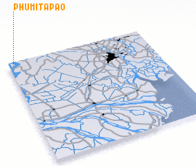 Places with similar names to Phumĭ Tapaô, Cambodia ::
// Phumĭ Dépo (KH)
// Phumĭ Ta Pa (KH)
// Phumĭ Ta Paô (KH)
// Phumĭ Ta Pŏu (KH)
// Phumĭ Tapŏu (KH)
// Phumĭ Ta Pôy (KH)
// Phumĭ Tipoŭ (KH)
// Phumĭ Tipoŭ (KH)
// Phum Tapô (VN)
Disclaimer :: Information on this page comes without warranty of any kind |
||
|
Where is Phumĭ Tapaô? Elevation and coordinates ::
Latitude (lat): 10°58'0"N Longitude (lon): 106°2'0"E
Elevation (approx.): 5m (map arrows pan, magnifying glasses zoom) |
||
|
Visiting Phumĭ Tapaô? Hotel/Accommodation ::
Book a hotel in Phumĭ Tapaô Travel Guide ::
Buy a travel guide for Cambodia rental cars ::
car rental offers GPS waypoint ::
download a GPX waypoint (PoI) of Phumĭ Tapaô for your GPS receiver
|
||