|
search place name
|
||
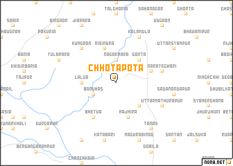
Chhotapota (Barisāl, Bangladesh)Chhotapota is a town in the Barisāl region of Bangladesh. An overview map of the region around Chhotapota is displayed below.
regional and 3d topo map of Chhotapota, Bangladesh ::
Chhotapota airports ::
The nearest airport is IRD - Ishurdi, located 45.6 km south west of Chhotapota.
Other airports nearby include RJH - Rajshahi Shah Mokhdum (71.2 km west), DAC - Dhaka Zia Intl (130.7 km south east), JSR - Jessore (144.8 km south), SPD - Saidpur (147.2 km north), Nearby towns ::
Baragaon (2.5km north west) //
Nāgarpāra (3.7km north) //
Bāruhās (3.8km south west) //
Binsara (5.0km south east) //
Gonta (5.0km north east) //
Lālua (5.1km west) //
Mājhira (5.8km south) //
Gurpipul (5.4km east) //
Nisindra (5.8km north) //
Bhetua (6.5km south west) //
Nāra Teghari (7.0km east) //
Kumgaon (7.5km north west) //
Uttar Mathurāpur (7.7km south east) //
Kālāmula (8.1km north east) //
Tārās (9.0km south east) //
[all distances 'as the bird flies' and approximate] 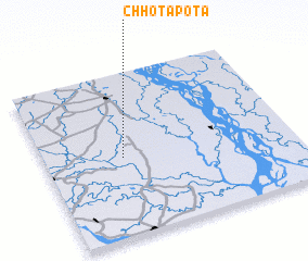 Places with similar names to Chhotapota, Bangladesh ::
// Chhota Pāta (BD)
// Chetput (IN)
// Chettippattu (IN)
// Chatpat (PK)
// Chhatta Pāda (PK)
// Chetput (IN)
// Chitapata (BO)
// Chutapata (BO)
Disclaimer :: Information on this page comes without warranty of any kind |
||
|
Where is Chhotapota? Elevation and coordinates ::
Latitude (lat): 24°29'0"N Longitude (lon): 89°19'0"E
Elevation (approx.): 12m (map arrows pan, magnifying glasses zoom) |
||
|
Visiting Chhotapota? Hotel/Accommodation ::
Book a hotel in Chhotapota Travel Guide ::
Buy a travel guide for Bangladesh rental cars ::
car rental offers GPS waypoint ::
download a GPX waypoint (PoI) of Chhotapota for your GPS receiver
|
||