|
search place name
|
||
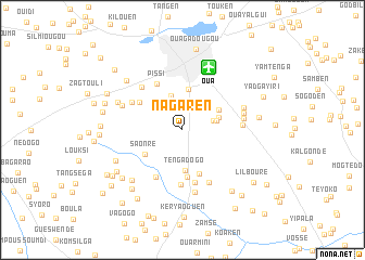
Nagaren (Kadiogo, Burkina Faso)Nagaren is a town in the Kadiogo region of Burkina Faso. An overview map of the region around Nagaren is displayed below.
regional and 3d topo map of Nagaren, Burkina Faso ::
Nagaren airports ::
The nearest airport is OUA - Ouagadougou, located 6.9 km north east of Nagaren.
Nearby towns ::
Soniaba (2.4km north) //
Kouritenga (3.0km north) //
Banogo (3.2km east) //
Yargo (3.6km east) //
Sissen (3.7km north) //
Zone de la Patte dʼOie (3.8km north east) //
Kossiam (3.9km east) //
Zone pilote de Sissen (4.2km north) //
Tengadogo (4.2km south) //
Koanguen (4.2km north east) //
Saonré (4.5km south west) //
Garguen (4.8km south) //
Baskoudré (4.9km south) //
Bonam (5.2km north west) //
Pissi (5.4km north west) //
Boulwango (5.5km south) //
Popala (5.6km south) //
Poéssé (5.6km south west) //
Bika (5.8km north west) //
Kamsaongtenga (6.0km south east) //
Yabrétenga (6.0km north west) //
Nabmanaguéma (6.1km east) //
Nogtaba (6.2km east) //
Boulbi (6.5km south) //
Lalnoyiri (6.4km east) //
Sandogo (6.6km west) //
Koubri Nabmanaguéma (6.6km east) //
Sabou (7.1km north west) //
Zéguédessé (7.2km south west) //
[all distances 'as the bird flies' and approximate] 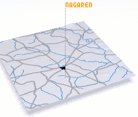 Places with similar names to Nagaren, Burkina Faso ::
// Neugrün (DE)
// Neugrün (DE)
// Neu Göhren (DE)
// Neu Karin (DE)
// Neu Krien (DE)
// Néa Koróni (GR)
// Nekrūnai (LT)
// Negrín (CU)
// Negreni (RO)
// Negreni (RO)
Disclaimer :: Information on this page comes without warranty of any kind |
||
|
Where is Nagaren? Elevation and coordinates ::
Latitude (lat): 12°17'44"N Longitude (lon): 1°32'13"W
Elevation (approx.): 327m (map arrows pan, magnifying glasses zoom) |
||
|
Visiting Nagaren? Hotel/Accommodation ::
Book a hotel in Nagaren Travel Guide ::
rental cars ::
car rental offers GPS waypoint ::
download a GPX waypoint (PoI) of Nagaren for your GPS receiver
|
||