|
search place name
|
||
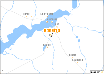
Banbito (Central African Republic)Banbito is a town in Central African Republic. An overview map of the region around Banbito is displayed below.
regional and 3d topo map of Banbito, Central African Republic ::
Nearby towns ::
Kourouko (2.6km north east) //
Nagpanga (4.1km north east) //
Obo (4.1km north east) //
Poupou (4.1km south west) //
Gousgoua (5.6km north) //
Ganikpio (5.9km north) //
Zouasa (5.9km north) //
Dakatimonga (7.6km north) //
Pania (10.5km north west) //
Zougo (10.5km south east) //
Foupio (10.5km south east) //
[all distances 'as the bird flies' and approximate]  Places with similar names to Banbito, Central African Republic ::
// Baunu” Bata” (PH)
// Ban Ai Bu Tae (TH)
// Ban Ba Do (TH)
// Ban Boet (TH)
// Ban Boet (TH)
// Ban Bo It (TH)
// Ban Bot (TH)
// Ban Bot (TH)
// Ban Bot (TH)
// Ban Bo To (TH)
Disclaimer :: Information on this page comes without warranty of any kind |
||
|
Where is Banbito? Elevation and coordinates ::
Latitude (lat): 5°22'0"N Longitude (lon): 26°29'0"E
Elevation (approx.): 621m (map arrows pan, magnifying glasses zoom) |
||
|
Visiting Banbito? Hotel/Accommodation ::
Book a hotel in Banbito Travel Guide ::
rental cars ::
car rental offers GPS waypoint ::
download a GPX waypoint (PoI) of Banbito for your GPS receiver
|
||