|
search place name
|
||
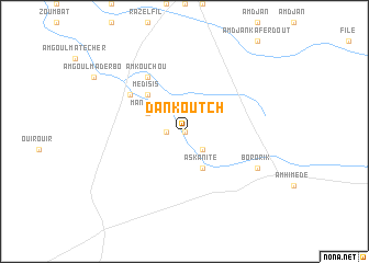
Dankoutch (Batha, Chad)Dankoutch is a town in the Batha region of Chad. An overview map of the region around Dankoutch is displayed below.
regional and 3d topo map of Dankoutch, Chad ::
Dankoutch airports ::
The nearest airport is AEH - Abeche, located 88.4 km north east of Dankoutch.
Nearby towns ::
Darmoli (0.0km north) //
Eséré (1.8km west) //
Dori Kalam (2.6km south east) //
Askanité (4.1km south east) //
Manzolo (4.1km north west) //
Médisis (5.2km north west) //
Am Goulma Atomat (6.6km north west) //
Am Kouchou (6.6km north west) //
Bororik (8.1km south east) //
[all distances 'as the bird flies' and approximate] 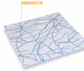 Places with similar names to Dankoutch, Chad ::
// Dankoutch (TD)
// Dankoutch (TD)
// Tang-t'ieh-shui (TW)
// T'ung-t'ou-chiao (TW)
// Dong Tchao (VN)
// Dongtuchi (CN)
Disclaimer :: Information on this page comes without warranty of any kind |
||
|
Where is Dankoutch? Elevation and coordinates ::
Latitude (lat): 13°29'0"N Longitude (lon): 20°7'0"E
Elevation (approx.): 420m (map arrows pan, magnifying glasses zoom) |
||
|
Visiting Dankoutch? Hotel/Accommodation ::
Book a hotel in Dankoutch Travel Guide ::
Buy a travel guide for Chad rental cars ::
car rental offers GPS waypoint ::
download a GPX waypoint (PoI) of Dankoutch for your GPS receiver
|
||