|
search place name
|
||
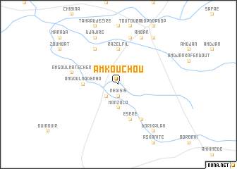
Am Kouchou (Batha, Chad)Am Kouchou is a town in the Batha region of Chad. An overview map of the region around Am Kouchou is displayed below.
regional and 3d topo map of Am Kouchou, Chad ::
Am Kouchou airports ::
The nearest airport is AEH - Abeche, located 89.3 km north east of Am Kouchou.
Nearby towns ::
Médisis (1.9km south) //
Am Goulma Atomat (2.6km south west) //
Manzolo (3.7km south) //
Raz el Fil (5.6km north) //
Am Goulma Derbo (5.4km west) //
Am Goulma Amberkotio (5.4km west) //
Eséré (5.8km south) //
Djoubdjoumala (6.6km north west) //
Darmoli (6.6km south east) //
Dankoutch (6.6km south east) //
Am Goulma Técher (7.4km west) //
Marzouga (7.6km north) //
Djajiré (8.2km north west) //
Am Bar (8.2km north east) //
Oualad Baachoum (8.2km north east) //
Dori Kalam (9.2km south east) //
Outach (9.2km north east) //
[all distances 'as the bird flies' and approximate] 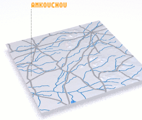 Places with similar names to Am Kouchou, Chad ::
// Amgoch (TD)
// Am Gouchie (TD)
// Am Kachao (TD)
// Am Kachaoua (TD)
// Am Kachouay (TD)
// Amacocha (CO)
// Amo Kach (PK)
// Āmgāchhi (BD)
// Āmgāchhi (BD)
Disclaimer :: Information on this page comes without warranty of any kind |
||
|
Where is Am Kouchou? Elevation and coordinates ::
Latitude (lat): 13°32'0"N Longitude (lon): 20°5'0"E
Elevation (approx.): 416m (map arrows pan, magnifying glasses zoom) |
||
|
Visiting Am Kouchou? Hotel/Accommodation ::
Book a hotel in Am Kouchou Travel Guide ::
Buy a travel guide for Chad rental cars ::
car rental offers GPS waypoint ::
download a GPX waypoint (PoI) of Am Kouchou for your GPS receiver
|
||