|
search place name
|
||
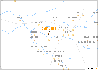
Djajiré (Batha, Chad)Djajiré is a town in the Batha region of Chad. An overview map of the region around Djajiré is displayed below.
regional and 3d topo map of Djajiré, Chad ::
Djajiré airports ::
The nearest airport is AEH - Abeche, located 90.2 km east of Djajiré.
Nearby towns ::
Djoubdjoumala (1.9km south) //
Tama Adjéziré (1.9km north) //
Raz el Fil (4.1km south east) //
Nialkata (4.1km north east) //
Chibina (5.2km north west) //
Marada (5.4km west) //
Marzouga (5.4km east) //
Diseyré (5.8km north) //
Kornoe (5.8km north) //
Zoumbat (5.7km west) //
Toutouba (5.7km east) //
Am Goulma Técher (6.6km south west) //
Oualad Baachoum (7.2km east) //
Am Bar (7.2km east) //
Am Goulma Derbo (7.6km south) //
Am Goulma Amberkotio (7.6km south) //
Am Kouchou (8.2km south east) //
[all distances 'as the bird flies' and approximate] 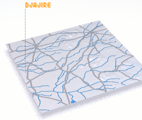 Places with similar names to Djajiré, Chad :: Disclaimer :: Information on this page comes without warranty of any kind |
||
|
Where is Djajiré? Elevation and coordinates ::
Latitude (lat): 13°36'0"N Longitude (lon): 20°3'0"E
Elevation (approx.): 417m (map arrows pan, magnifying glasses zoom) |
||
|
Visiting Djajiré? Hotel/Accommodation ::
Book a hotel in Djajiré Travel Guide ::
Buy a travel guide for Chad rental cars ::
car rental offers GPS waypoint ::
download a GPX waypoint (PoI) of Djajiré for your GPS receiver
|
||