|
search place name
|
||
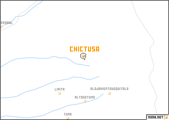
Chictusa (Tarapacá, Chile)Chictusa is a town in the Tarapacá region of Chile. An overview map of the region around Chictusa is displayed below.
regional and 3d topo map of Chictusa, Chile ::
Chictusa airports ::
The nearest airport is IQQ - Iquique Diego Aracena Intl, located 121.0 km west of Chictusa.
Other airports nearby include CJC - Calama El Loa (190.5 km south), Nearby towns ::
Lipita (9.1km south west) //
Alojamiento de Quitala (9.1km south east) //
[all distances 'as the bird flies' and approximate] 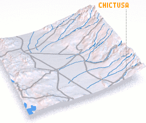 Places with similar names to Chictusa, Chile ::
// Shqitas (AL)
// Chagüites (GT)
// Shoktas (KZ)
// Chagatas (UZ)
// Chagüites (HN)
// Chagüites (HN)
// Chagüites (HN)
// Chicuatuáza (MZ)
// Chicutso (MZ)
// Ch'i-kou-tzu (TW)
Disclaimer :: Information on this page comes without warranty of any kind |
||
|
Where is Chictusa? Elevation and coordinates ::
Latitude (lat): 20°47'0"S Longitude (lon): 69°3'0"W
Elevation (approx.): 3009m (map arrows pan, magnifying glasses zoom) |
||
|
Visiting Chictusa? Hotel/Accommodation ::
Book a hotel in Chictusa Travel Guide ::
Buy a travel guide for Chile rental cars ::
car rental offers GPS waypoint ::
download a GPX waypoint (PoI) of Chictusa for your GPS receiver
|
||