|
search place name
|
||
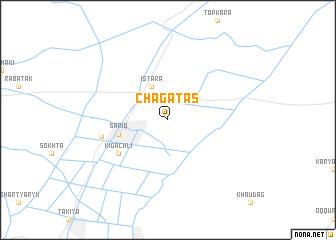
Chagatas (Uzbekistan)Chagatas is a town in Uzbekistan. An overview map of the region around Chagatas is displayed below.
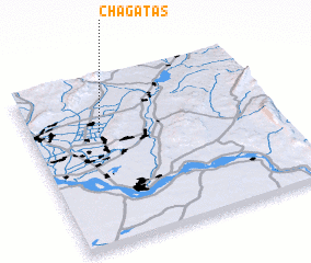
regional and 3d topo map of Chagatas, Uzbekistan ::
Chagatas airports ::
The nearest airport is MZR - Mazar-i-sharif Mazar I Sharif, located 108.6 km south of Chagatas.
Other airports nearby include DYU - Dushanbe (165.5 km north east), UND - Kunduz Konduz (183.5 km south east), Nearby towns ::
 Places with similar names to Chagatas, Uzbekistan ::
// Shqitas (AL)
// Chictusa (CL)
// Chagüites (GT)
// Shoktas (KZ)
// Chagüites (HN)
// Chagüites (HN)
// Chagüites (HN)
// Chicuatuáza (MZ)
// Chicutso (MZ)
// Ch'i-kou-tzu (TW)
Disclaimer :: Information on this page comes without warranty of any kind |
||
|
Where is Chagatas? Elevation and coordinates ::
Latitude (lat): 37°41'0"N Longitude (lon): 67°17'0"E
Elevation (approx.): 390m (map arrows pan, magnifying glasses zoom) |
||
|
Visiting Chagatas? Hotel/Accommodation ::
Book a hotel in Chagatas Travel Guide ::
Buy a travel guide for Uzbekistan rental cars ::
car rental offers GPS waypoint ::
download a GPX waypoint (PoI) of Chagatas for your GPS receiver
|
||