|
search place name
|
||
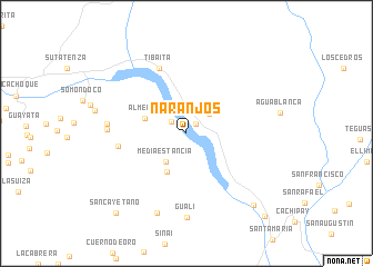
Naranjos (Boyacá, Colombia)Naranjos is a town in the Boyacá region of Colombia. An overview map of the region around Naranjos is displayed below.
regional and 3d topo map of Naranjos, Colombia ::
Naranjos airports ::
The nearest airport is VVC - Villavicencio Vanguardia, located 92.4 km south of Naranjos.
Other airports nearby include BOG - Bogota Eldorado Intl (93.7 km west), IBE - Ibague Perales (207.4 km west), TME - Tame (240.8 km north east), Nearby towns ::
Batá (1.4km north east) //
Tona (1.9km north west) //
Macanal (3.0km north east) //
Media Estancia (3.5km south west) //
Boquerón de Chivor (4.3km south west) //
Almeida (4.4km west) //
Molinos (7.0km west) //
Tibaita (7.1km north west) //
Cristo Rey (8.0km west) //
San Sebastian (8.0km west) //
Guali (8.4km south) //
Chivor (8.6km south) //
Campamento Las Moyas (9.9km south east) //
San Cayetano (10.6km south west) //
Sitio Muras (11.4km south east) //
[all distances 'as the bird flies' and approximate] 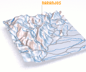 Places with similar names to Naranjos, Colombia ::
Disclaimer :: Information on this page comes without warranty of any kind |
||
|
Where is Naranjos? Elevation and coordinates ::
Latitude (lat): 4°57'28"N Longitude (lon): 73°20'31"W
Elevation (approx.): 1387m (map arrows pan, magnifying glasses zoom) |
||
|
Visiting Naranjos? Hotel/Accommodation ::
Book a hotel in Naranjos Travel Guide ::
Buy a travel guide for Colombia rental cars ::
car rental offers GPS waypoint ::
download a GPX waypoint (PoI) of Naranjos for your GPS receiver
|
||