|
search place name
|
||
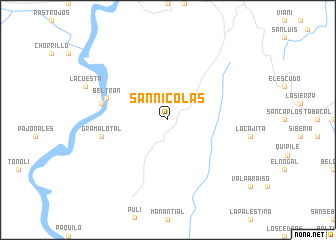
San Nicolás (Cundinamarca, Colombia)San Nicolás is a town in the Cundinamarca region of Colombia. An overview map of the region around San Nicolás is displayed below.
regional and 3d topo map of San Nicolás, Colombia ::
San Nicolás airports ::
The nearest airport is BOG - Bogota Eldorado Intl, located 60.2 km east of San Nicolás.
Other airports nearby include IBE - Ibague Perales (64.0 km south west), MZL - Manizales La Nubia (90.8 km west), PEI - Pereira Matecana (117.2 km west), AXM - Armenia El Eden (125.6 km west), Nearby towns ::
Beltrán (7.3km west) //
Gramalotal (7.6km west) //
Puerto Beltrancito (7.6km west) //
[all distances 'as the bird flies' and approximate] 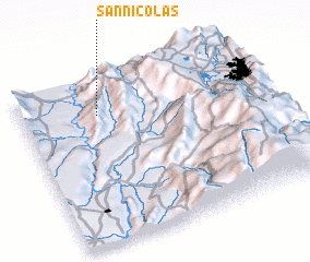 Places with similar names to San Nicolás, Colombia ::
// Zünqülǝş (AZ)
// Singlis (DE)
// Cengles (IT)
// San Nicolas (IT)
// San Nicolás (CU)
// San Nicolás (CU)
// San Nicolás (CU)
// San Nicolás (CU)
// San Nicolás (CU)
// San Nicolás (CU)
Disclaimer :: Information on this page comes without warranty of any kind |
||
|
Where is San Nicolás? Elevation and coordinates ::
Latitude (lat): 4°47'0"N Longitude (lon): 74°41'0"W
Elevation (approx.): 962m (map arrows pan, magnifying glasses zoom) |
||
|
Visiting San Nicolás? Hotel/Accommodation ::
Book a hotel in San Nicolás Travel Guide ::
Buy a travel guide for Colombia rental cars ::
car rental offers GPS waypoint ::
download a GPX waypoint (PoI) of San Nicolás for your GPS receiver
|
||