|
search place name
|
||
Santa Ana (Magdalena, Colombia)Santa Ana is a town in the Magdalena region of Colombia. An overview map of the region around Santa Ana is displayed below.
regional and 3d topo map of Santa Ana, Colombia ::

Santa Ana airports ::
The nearest airport is MGN - Magangue Baracoa, located 30.0 km west of Santa Ana.
Other airports nearby include CZU - Corozal Las Brujas (78.0 km west), MTR - Monteria Los Garzones (148.1 km west), CTG - Cartagena Rafael Nunez (160.9 km north west), OCV - Ocana Aguas Claras (174.3 km south east), Nearby towns ::
La Ladera (1.0km west) //
Talaigua Viejo (1.5km south) //
Talaigua Nuevo (2.0km south east) //
Jaraba (3.0km east) //
La Salvadora (4.3km east) //
Peñón de Durán (4.9km north west) //
Las Palmitas (5.4km north east) //
Nueva Esperanza (5.4km north west) //
San Fernando (6.7km south east) //
Gavilán (7.4km north) //
Patico (7.7km north west) //
El Vesubio (7.9km south east) //
San Fernando (8.0km south east) //
Punta de Cartagena (8.3km south west) //
El Jardín (8.6km south) //
Coalición (8.6km south) //
El Limón (8.8km east) //
El Cardón (9.0km north) //
El Limón (9.0km south west) //
La Dicha (9.1km north) //
Pedro Fernández (9.1km north east) //
Barro Blanco (9.2km north west) //
Arroyo Arriba (9.3km north east) //
San Rafael (9.3km north east) //
Buenos Aires (9.4km south east) //
La Isabel (9.4km south east) //
Las Mendozas (9.4km south east) //
El Otoño (9.6km north east) //
Ceibal (10.5km south east) //
[all distances 'as the bird flies' and approximate] 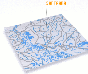 Places with similar names to Santa Ana, Colombia ::
Disclaimer :: Information on this page comes without warranty of any kind |
||
|
Where is Santa Ana? Elevation and coordinates ::
Latitude (lat): 9°19'25"N Longitude (lon): 74°34'33"W
Elevation (approx.): 19m (map arrows pan, magnifying glasses zoom) |
||
|
Visiting Santa Ana? Hotel/Accommodation ::
Book a hotel in Santa Ana Travel Guide ::
Buy a travel guide for Colombia rental cars ::
car rental offers GPS waypoint ::
download a GPX waypoint (PoI) of Santa Ana for your GPS receiver
|
||