|
search place name
|
||
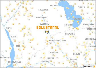
Solvetanal (Antioquia, Colombia)Solvetanal is a town in the Antioquia region of Colombia. An overview map of the region around Solvetanal is displayed below.
regional and 3d topo map of Solvetanal, Colombia ::
Solvetanal airports ::
The nearest airport is EOH - Medellin Olaya Herrera, located 45.3 km south of Solvetanal.
Other airports nearby include MDE - Rio Negro Jose Maria Cordova (57.9 km south east), OTU - Otu (115.1 km east), UIB - Quibdo El Carano (147.8 km south west), MZL - Manizales La Nubia (177.5 km south), Nearby towns ::
Los Patos (1.4km north west) //
La Aldaña (1.5km south west) //
Belmira (1.7km south east) //
Azucenos (2.1km south east) //
Aguirre (2.6km south) //
Santa Rita Rivera (2.8km south) //
Candelaria (2.9km north east) //
El Yerbal (3.1km north west) //
Vélez (3.5km south) //
Santa Rita (3.7km south) //
Peñitas (3.9km south) //
La Verde (4.4km north east) //
Palenque (5.2km north) //
Salazar Restrepo (5.2km south east) //
San Francisco (5.2km south east) //
San Francisco Pérez (5.3km south) //
La Casita (5.6km south west) //
El Cherillo (5.7km south) //
San Joaquín (5.8km north west) //
Salazar Gómez (5.9km east) //
Palacio (6.0km west) //
Matasano (6.3km south east) //
El Hoyo (6.5km west) //
Los Aguacates (6.7km west) //
La Ultima Copa (6.9km south east) //
Seminario (7.0km west) //
Santo Domingo (7.0km south east) //
Horizontes (7.2km west) //
El Hoyo de La Peña (7.4km west) //
[all distances 'as the bird flies' and approximate] 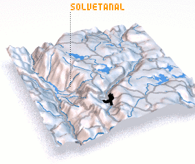 Places with similar names to Solvetanal, Colombia :: Disclaimer :: Information on this page comes without warranty of any kind |
||
|
Where is Solvetanal? Elevation and coordinates ::
Latitude (lat): 6°37'11"N Longitude (lon): 75°40'51"W
Elevation (approx.): 2590m (map arrows pan, magnifying glasses zoom) |
||
|
Visiting Solvetanal? Hotel/Accommodation ::
Book a hotel in Solvetanal Travel Guide ::
Buy a travel guide for Colombia rental cars ::
car rental offers GPS waypoint ::
download a GPX waypoint (PoI) of Solvetanal for your GPS receiver
|
||