|
search place name
|
||
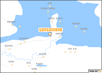
Dongo-Niama (Sangha, Congo, Republic of the)Dongo-Niama is a town in the Sangha region of Congo, Republic of the. An overview map of the region around Dongo-Niama is displayed below.
regional and 3d topo map of Dongo-Niama, Congo, Republic of the ::
Dongo-Niama airports ::
The nearest airport is FTX - Owando, located 70.8 km south of Dongo-Niama.
Other airports nearby include OUE - Ouesso (167.6 km north), Nearby towns ::
 Places with similar names to Dongo-Niama, Congo, Republic of the ::
// Taungnimaw (MM)
// Toungounamba I (GA)
// Toungounamba II (GA)
// Dan Kunama (NG)
// Tanganama (NG)
// Tunga Nama (NG)
// Tunga Nama (NG)
// Tungan Noma (NG)
// Tungan Numa (NG)
// Tungan Numa (NG)
Disclaimer :: Information on this page comes without warranty of any kind |
||
|
Where is Dongo-Niama? Elevation and coordinates ::
Latitude (lat): 0°6'1"S Longitude (lon): 16°3'12"E
Elevation (approx.): 319m (map arrows pan, magnifying glasses zoom) |
||
|
Visiting Dongo-Niama? Hotel/Accommodation ::
Book a hotel in Dongo-Niama Travel Guide ::
rental cars ::
car rental offers GPS waypoint ::
download a GPX waypoint (PoI) of Dongo-Niama for your GPS receiver
|
||