|
search place name
|
||
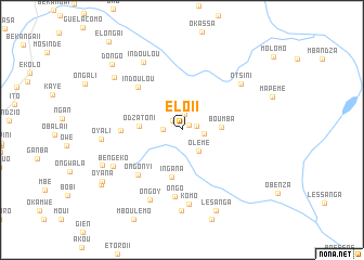
Elo II (Plateaux, Congo, Republic of the)Elo II is a town in the Plateaux region of Congo, Republic of the. An overview map of the region around Elo II is displayed below.
regional and 3d topo map of Elo II, Congo, Republic of the ::
Elo II airports ::
The nearest airport is FTX - Owando, located 113.2 km north of Elo II.
Other airports nearby include FDU - Bandoundu Bandundu (244.5 km south east), Nearby towns ::
Elo III (0.9km north east) //
Elo I (1.4km north west) //
Otsiendé (1.5km east) //
Epounou (1.7km north) //
Mbobo (2.0km west) //
Okonga (2.3km east) //
Olémé (2.8km south east) //
Boumba (4.1km east) //
Odzatoni (4.5km west) //
Ingana (5.0km south) //
Indoulou (6.4km north west) //
Indzie (6.4km west) //
Ongonyi (6.5km south west) //
Ongo (6.9km south) //
Otsini (7.7km north east) //
Komo (7.7km south) //
Ongoy (7.9km south west) //
Bengéko (8.0km south west) //
Indoulou (8.1km north west) //
Ongo III (8.3km south) //
Oyali (8.4km west) //
Okaye (8.8km north west) //
Bangasou (9.0km south west) //
Lesanga (9.1km south east) //
Oyana (9.7km south west) //
Dongo (9.9km north west) //
Efoundou (10.0km south west) //
[all distances 'as the bird flies' and approximate] 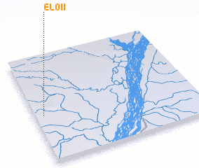 Places with similar names to Elo II, Congo, Republic of the ::
Disclaimer :: Information on this page comes without warranty of any kind |
||
|
Where is Elo II? Elevation and coordinates ::
Latitude (lat): 1°32'59"S Longitude (lon): 16°3'13"E
Elevation (approx.): 334m (map arrows pan, magnifying glasses zoom) |
||
|
Visiting Elo II? Hotel/Accommodation ::
Book a hotel in Elo II Travel Guide ::
rental cars ::
car rental offers GPS waypoint ::
download a GPX waypoint (PoI) of Elo II for your GPS receiver
|
||