|
search place name
|
||
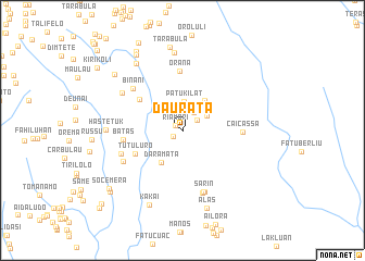
Daurata (Timor Timur, East Timor)Daurata is a town in the Timor Timur region of East Timor. An overview map of the region around Daurata is displayed below.
regional and 3d topo map of Daurata, East Timor ::
Daurata airports ::
The nearest airport is DIL - Dili Presidente Nicolau Lobato Intl, located 49.6 km north west of Daurata.
Nearby towns ::
Ainesi (0.7km north) //
Riamori (0.9km north west) //
Orilo (1.2km south west) //
Bobolora (1.8km north east) //
Aituha (2.2km north east) //
Orlora (2.8km north) //
Bubususu (2.9km north east) //
Patukilat (3.0km north) //
Liholau (3.2km north east) //
Ilate (3.8km north east) //
Daramata (3.9km south west) //
Tutu Luro (5.4km south west) //
Aidila (5.4km north west) //
Orana (6.1km north) //
Caicassa (6.1km east) //
Batas (6.1km west) //
Binani (6.6km north west) //
Sarin (6.7km south) //
Leodato (6.7km south) //
Ailau (6.7km west) //
Raiguesa (6.8km south) //
Bubulau (6.8km south west) //
Maubisse (7.3km north west) //
Hastetuk (7.8km west) //
Fatulelo (8.0km north) //
Alas (8.4km south) //
Furaclau (8.4km north west) //
Kakai (8.4km south west) //
Tarabula (8.6km north) //
[all distances 'as the bird flies' and approximate] 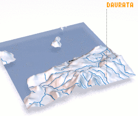 Places with similar names to Daurata, East Timor ::
Disclaimer :: Information on this page comes without warranty of any kind |
||
|
Where is Daurata? Elevation and coordinates ::
Latitude (lat): 8°55'42"S Longitude (lon): 125°45'38"E
Elevation (approx.): 914m (map arrows pan, magnifying glasses zoom) |
||
|
Visiting Daurata? Hotel/Accommodation ::
Book a hotel in Daurata Travel Guide ::
Buy a travel guide for East Timor rental cars ::
car rental offers GPS waypoint ::
download a GPX waypoint (PoI) of Daurata for your GPS receiver
|
||