|
search place name
|
||
Fatukmetan (Timor Timur, East Timor)Fatukmetan is a town in the Timor Timur region of East Timor. An overview map of the region around Fatukmetan is displayed below.
regional and 3d topo map of Fatukmetan, East Timor ::

Fatukmetan airports ::
The nearest airport is DIL - Dili Presidente Nicolau Lobato Intl, located 100.6 km north east of Fatukmetan.
Nearby towns ::
Tulaiduk (1.8km north east) //
Walalama (1.9km south west) //
Nikir (2.2km west) //
Maudemu (2.3km east) //
Tilomar (2.5km east) //
Halimea (2.5km east) //
Kotafoun (3.0km east) //
Maubesi (3.6km north west) //
Baer (4.6km north) //
Foholulik (4.9km north west) //
Fatuklaran (6.0km north) //
Dacolo (6.0km north west) //
Fatuha (6.3km south west) //
Fatubesi (6.7km north) //
Maubesi (6.7km south west) //
Fohorem (7.2km north) //
Luankobo (7.2km south west) //
Sadahor (7.2km north) //
Aitos (7.3km north) //
Maubesi (7.3km north) //
Lalimaren (7.3km south west) //
Fatukbitiklaran (7.4km north) //
Debukbabit (7.3km south west) //
Loohali (7.4km north) //
Makokon (7.4km north west) //
Kotabiru (7.4km south west) //
Fatukain (7.5km south west) //
Nularan (7.6km north) //
Ailala (7.6km west) //
[all distances 'as the bird flies' and approximate] 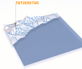 Places with similar names to Fatukmetan, East Timor ::
// Fatukmetan (ID)
// Fadouga Madina (ML)
Disclaimer :: Information on this page comes without warranty of any kind |
||
|
Where is Fatukmetan? Elevation and coordinates ::
Latitude (lat): 9°20'54"S Longitude (lon): 125°5'31"E
Elevation (approx.): 437m (map arrows pan, magnifying glasses zoom) |
||
|
Visiting Fatukmetan? Hotel/Accommodation ::
Book a hotel in Fatukmetan Travel Guide ::
Buy a travel guide for East Timor rental cars ::
car rental offers GPS waypoint ::
download a GPX waypoint (PoI) of Fatukmetan for your GPS receiver
|
||