|
search place name
|
||
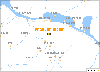
Fadouga Madina (Mali)Fadouga Madina is a town in Mali. An overview map of the region around Fadouga Madina is displayed below.
regional and 3d topo map of Fadouga Madina, Mali ::
Fadouga Madina airports ::
The nearest airport is BXE - Bakel, located 36.3 km north west of Fadouga Madina.
Other airports nearby include SEY - Selibabi Selibady (53.3 km north), KYS - Kayes Dag Dag (85.6 km east), TUD - Tambacounda (192.6 km south west), KED - Kaedi (216.3 km north west), Nearby towns ::
Sébou (2.6km south west) //
Goundiamou (3.7km south) //
Kotéra (5.6km north) //
Tafassirga (5.8km north) //
Dedji (6.6km south west) //
Sintiou Déboukoulé (7.6km south) //
Solou (7.6km north) //
Ségala (7.7km north east) //
Khabou Kaméra (8.1km north east) //
[all distances 'as the bird flies' and approximate] 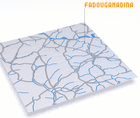 Places with similar names to Fadouga Madina, Mali ::
// Fatukmetan (TP)
// Fatukmetan (ID)
Disclaimer :: Information on this page comes without warranty of any kind |
||
|
Where is Fadouga Madina? Elevation and coordinates ::
Latitude (lat): 14°42'0"N Longitude (lon): 12°10'0"W
Elevation (approx.): 27m (map arrows pan, magnifying glasses zoom) |
||
|
Visiting Fadouga Madina? Hotel/Accommodation ::
Book a hotel in Fadouga Madina Travel Guide ::
Buy a travel guide for Mali rental cars ::
car rental offers GPS waypoint ::
download a GPX waypoint (PoI) of Fadouga Madina for your GPS receiver
|
||