|
search place name
|
||
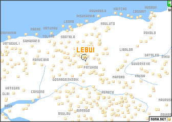
Lebui (Timor Timur, East Timor)Lebui is a town in the Timor Timur region of East Timor. An overview map of the region around Lebui is displayed below.
regional and 3d topo map of Lebui, East Timor ::
Lebui airports ::
The nearest airport is DIL - Dili Presidente Nicolau Lobato Intl, located 22.2 km north east of Lebui.
Nearby towns ::
Manufatia (0.6km south) //
Natare (1.1km north) //
Caileli (1.5km north west) //
Fahate (1.5km south west) //
Baura (1.8km east) //
Metagao (1.9km north) //
Asorlema (2.1km north) //
Boelema (2.1km south west) //
Carolema (2.1km north west) //
Nunturi (2.1km north west) //
Lebuhai (2.4km west) //
Mangkir (2.5km south) //
Lebuana (2.6km north) //
Hunahai (2.7km north) //
Urema (2.7km east) //
Ecapo (2.7km south east) //
Kutulau (2.7km north east) //
Ergoa (2.8km south) //
Kirilelo (2.8km north west) //
Hatululi (2.8km north west) //
Fatuhou (2.9km south east) //
Vazetida Algar (2.9km west) //
Baura (2.9km east) //
Caicassico (3.3km south) //
Kaileulema (3.4km north) //
Lebosalara (3.4km west) //
Urluli (3.5km south east) //
Metaluli (3.6km north) //
Hatumasi (3.7km west) //
[all distances 'as the bird flies' and approximate] 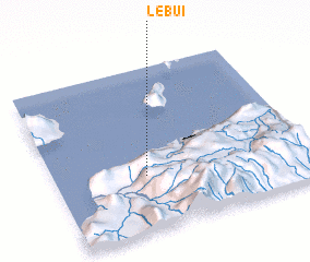 Places with similar names to Lebui, East Timor ::
Disclaimer :: Information on this page comes without warranty of any kind |
||
|
Where is Lebui? Elevation and coordinates ::
Latitude (lat): 8°39'33"S Longitude (lon): 125°21'26"E
Elevation (approx.): 1220m (map arrows pan, magnifying glasses zoom) |
||
|
Visiting Lebui? Hotel/Accommodation ::
Book a hotel in Lebui Travel Guide ::
Buy a travel guide for East Timor rental cars ::
car rental offers GPS waypoint ::
download a GPX waypoint (PoI) of Lebui for your GPS receiver
|
||