|
search place name
|
||
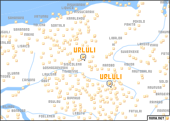
Urluli (Timor Timur, East Timor)Urluli is a town in the Timor Timur region of East Timor. An overview map of the region around Urluli is displayed below.
regional and 3d topo map of Urluli, East Timor ::
Urluli airports ::
The nearest airport is DIL - Dili Presidente Nicolau Lobato Intl, located 22.2 km north east of Urluli.
Nearby towns ::
Ecapo (0.8km north west) //
Fatuhou (0.9km west) //
Patunero (0.9km east) //
Ergoa (1.3km west) //
Manulete (1.4km east) //
Gorema (1.6km south east) //
Railuli (1.9km north east) //
Colaco (2.1km south east) //
Baura (2.4km north) //
Mauane (2.5km south east) //
Tarmausoru (2.6km south east) //
Mangkir (2.8km west) //
Manufatia (2.9km north west) //
Sacoco (3.0km south) //
Urema (3.2km north) //
Sisicolema (3.2km south west) //
Baura (3.4km north) //
Titibuti (3.4km south east) //
Caicassico (3.4km west) //
Lebui (3.5km north west) //
Fahate (3.5km north west) //
Sakoko (3.6km south) //
Nounanaro (3.9km south west) //
Boelema (4.0km west) //
Kutulau (4.1km north) //
Caissahe (4.1km south east) //
Natare (4.2km north west) //
Nunupu (4.3km south) //
Lauraehou (4.5km south) //
[all distances 'as the bird flies' and approximate] 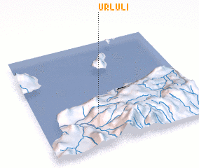
Disclaimer :: Information on this page comes without warranty of any kind |
||
|
Where is Urluli? Elevation and coordinates ::
Latitude (lat): 8°41'1"S Longitude (lon): 125°22'37"E
Elevation (approx.): 1147m (map arrows pan, magnifying glasses zoom) |
||
|
Visiting Urluli? Hotel/Accommodation ::
Book a hotel in Urluli Travel Guide ::
Buy a travel guide for East Timor rental cars ::
car rental offers GPS waypoint ::
download a GPX waypoint (PoI) of Urluli for your GPS receiver
|
||