|
search place name
|
||
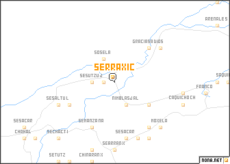
Serraxic (Alta Verapaz, Guatemala)Serraxic is a town in the Alta Verapaz region of Guatemala. An overview map of the region around Serraxic is displayed below.
regional and 3d topo map of Serraxic, Guatemala ::
Serraxic airports ::
The nearest airport is CBV - Coban, located 111.9 km west of Serraxic.
Other airports nearby include SAP - San Pedro Sula La Mesa Intl (167.3 km east), GUA - Guatemala City La Aurora (181.5 km south west), TEA - Tela (209.8 km east), BZE - Belize City Philip S W Goldson Intl (223.7 km north east), Nearby towns ::
Las Conchas (1.8km west) //
Sesutzuj (3.6km west) //
Nimblasjal (4.1km south east) //
Soselá (4.1km north west) //
Chabilchoch (6.5km south east) //
Gracias a Dios (7.7km north east) //
Semanzana (8.2km south west) //
Gracias a Dios (8.0km south west) //
Machaquilá (9.1km south east) //
El Calvario (9.0km north east) //
Moxelá (10.3km south east) //
[all distances 'as the bird flies' and approximate] 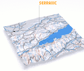 Places with similar names to Serraxic, Guatemala ::
// Seroczki (PL)
// Sroczków (PL)
// Sarakiškė (LT)
// Sarakiškiai (LT)
// Šarkiškiai (LT)
// Çerkezköy (TR)
// Sarıkaşık (TR)
// Sarıkuşak (TR)
// Zari Kasake (NG)
// Saarikoski (FI)
Disclaimer :: Information on this page comes without warranty of any kind |
||
|
Where is Serraxic? Elevation and coordinates ::
Latitude (lat): 15°50'0"N Longitude (lon): 89°26'0"W
Elevation (approx.): 114m (map arrows pan, magnifying glasses zoom) |
||
|
Visiting Serraxic? Hotel/Accommodation ::
Book a hotel in Serraxic Travel Guide ::
Buy a travel guide for Guatemala rental cars ::
car rental offers GPS waypoint ::
download a GPX waypoint (PoI) of Serraxic for your GPS receiver
|
||