|
search place name
|
||
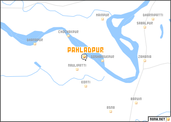
Pahlādpur (Uttar Pradesh, India)Pahlādpur is a town in the Uttar Pradesh region of India. An overview map of the region around Pahlādpur is displayed below.
regional and 3d topo map of Pahlādpur, India ::
Pahlādpur airports ::
The nearest airport is VNS - Varanasi, located 59.4 km west of Pahlādpur.
Other airports nearby include YOP - Gorakhpur (144.7 km north), PAT - Patina Patna (165.6 km east), GAY - Gaya (169.6 km south east), IXD - Allahabad (172.6 km west), Nearby towns ::
Nauli Patti (2.5km south west) //
Goshaīndepur (3.3km east) //
Eonti (5.6km south) //
Chochakpur (6.5km north west) //
[all distances 'as the bird flies' and approximate] 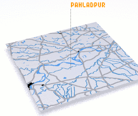 Places with similar names to Pahlādpur, India ::
// Paladeperre (ES)
// Pāltāpur (BD)
// Paltipāra (BD)
// Pāltipāra (BD)
// Pahlādpur (IN)
// Poladpur (IN)
// Pahlūdpur (PK)
// Palādpur (PK)
// Plei Dap Rao (VN)
// Peltoperä (FI)
Disclaimer :: Information on this page comes without warranty of any kind |
||
|
Where is Pahlādpur? Elevation and coordinates ::
Latitude (lat): 25°26'0"N Longitude (lon): 83°27'0"E
Elevation (approx.): 69m (map arrows pan, magnifying glasses zoom) |
||
|
Visiting Pahlādpur? Hotel/Accommodation ::
Book a hotel in Pahlādpur Travel Guide ::
Buy a travel guide for India rental cars ::
car rental offers GPS waypoint ::
download a GPX waypoint (PoI) of Pahlādpur for your GPS receiver
|
||