|
search place name
|
||
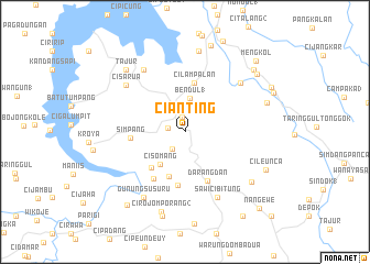
Cianting (Indonesia)Cianting is a town in Indonesia. An overview map of the region around Cianting is displayed below.
regional and 3d topo map of Cianting, Indonesia ::
Cianting airports ::
The nearest airport is CGK - Jakarta Soekarno Hatta Intl, located 100.5 km north west of Cianting.
Nearby towns ::
Cilalawi (1.5km north) //
Plered (1.8km west) //
Cibogohilir 2 (2.1km south west) //
Bendul 1 (3.5km north) //
Cisomang (4.2km south west) //
Nangtang (4.8km south) //
Cipeuncang (5.0km south west) //
Cilampalan (5.1km north) //
Depok (5.5km south) //
Darangdan (5.5km south east) //
Simpang (5.5km west) //
Ciwareng (5.7km south west) //
Sawicibitung (7.4km south east) //
Selakaya (7.5km north east) //
Ciseuti (7.6km north west) //
Cisarua (7.7km north west) //
Gunungsusuru (7.8km south west) //
Ciganea (8.3km north) //
Cilingga (8.4km south east) //
Cirojomporang 2 (8.4km south) //
Tajur (8.7km north west) //
Cikadongdong (8.8km south) //
Tanjungsari (8.8km east) //
Cileunca (9.0km south east) //
Bunder (9.1km north) //
Pasawahan (9.3km north east) //
Cihideung (9.4km north east) //
Cirojom Teggah (9.5km south west) //
Pondoksalam (9.8km north east) //
[all distances 'as the bird flies' and approximate] 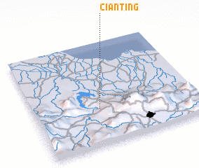 Places with similar names to Cianting, Indonesia ::
// Shandaung (MM)
// Shantaung (MM)
// Shantaungu (MM)
// Shanting (MM)
// Sheing Htang (MM)
// Chuntang (IN)
// Chantung (GH)
// Chandanke (PK)
// Chain-dong (KP)
// Ch'angho-dong (KP)
Disclaimer :: Information on this page comes without warranty of any kind |
||
|
Where is Cianting? Elevation and coordinates ::
Latitude (lat): 6°38'25"S Longitude (lon): 107°24'15"E
Elevation (approx.): 258m (map arrows pan, magnifying glasses zoom) |
||
|
Visiting Cianting? Hotel/Accommodation ::
Book a hotel in Cianting Travel Guide ::
Buy a travel guide for Indonesia rental cars ::
car rental offers GPS waypoint ::
download a GPX waypoint (PoI) of Cianting for your GPS receiver
|
||