|
search place name
|
||
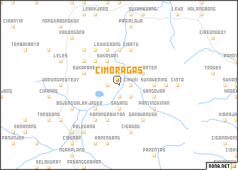
Cimoragas (Indonesia)Cimoragas is a town in Indonesia. An overview map of the region around Cimoragas is displayed below.
regional and 3d topo map of Cimoragas, Indonesia ::
Cimoragas airports ::
The nearest airport is CGK - Jakarta Soekarno Hatta Intl, located 184.0 km north west of Cimoragas.
Nearby towns ::
Cihuni (1.8km east) //
Babakan Loa (1.9km north) //
Banyuresmi (1.9km south) //
Wanaraja (1.9km south) //
Kopocondong (1.8km west) //
Gudang (2.6km south east) //
Sadang (3.7km south) //
Sagaranten (4.1km north east) //
Sukasari (4.1km north west) //
Jager (5.2km south west) //
Cibudug (5.2km north west) //
Sukawening (5.5km east) //
Cikoang (5.6km north) //
Cibatu (5.9km north) //
Sangojar (5.8km east) //
Karangpawitan (5.9km south) //
Leuwigoong (5.9km north) //
Sukarame (5.8km west) //
Garawangsa (6.7km south east) //
Panyingkiran (6.6km south east) //
Cangkuang (6.6km north west) //
Cimurah (6.7km south west) //
Gandamirah (6.7km north west) //
Caringin (7.4km east) //
Cigadog (7.6km south) //
Karangsari (7.8km north west) //
Bojongsalam (8.2km south west) //
Paledang (9.2km south west) //
Garut (10.4km south west) //
[all distances 'as the bird flies' and approximate] 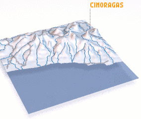 Places with similar names to Cimoragas, Indonesia ::
// São Marcos (BR)
// São Marcos (BR)
// São Marcos (BR)
// São Marcos (BR)
// São Marcos (BR)
// Zimbragós (GR)
// São Marcos (PT)
// São Marcos (PT)
// Samurcaşi (RO)
// Summer Oaks (US)
Disclaimer :: Information on this page comes without warranty of any kind |
||
|
Where is Cimoragas? Elevation and coordinates ::
Latitude (lat): 7°9'0"S Longitude (lon): 107°58'0"E
Elevation (approx.): 675m (map arrows pan, magnifying glasses zoom) |
||
|
Visiting Cimoragas? Hotel/Accommodation ::
Book a hotel in Cimoragas Travel Guide ::
Buy a travel guide for Indonesia rental cars ::
car rental offers GPS waypoint ::
download a GPX waypoint (PoI) of Cimoragas for your GPS receiver
|
||