|
search place name
|
||
Kandangan (Indonesia)Kandangan is a town in Indonesia. An overview map of the region around Kandangan is displayed below.
regional and 3d topo map of Kandangan, Indonesia ::

Nearby towns ::
Krembung (0.0km north) //
Besuk (0.3km north east) //
Mlaten (0.9km east) //
Cangkring (1.0km north west) //
Gempolegi (1.4km west) //
Keret (1.6km north) //
Bogem (2.1km north) //
Bulang (2.2km north west) //
Tlasih Satu (3.1km north) //
Pohjejer (3.1km west) //
Simpang (3.4km north west) //
Tulangan (4.4km north east) //
Kepunten (4.8km north) //
Ploso (5.0km west) //
Pungging (5.2km south west) //
Grabagan (5.3km north) //
Gedangrowo (5.3km north west) //
Kalitengah (5.4km west) //
Ngoro (5.6km south) //
Gading (5.6km west) //
Turi (6.0km north) //
Popoh (6.2km north) //
Ngrame (6.3km west) //
Bangun (6.4km west) //
Japanan (6.6km south east) //
Simo (6.9km north) //
Bandilan (7.0km north west) //
Prambon (6.9km north west) //
Wonoayu (7.1km north) //
[all distances 'as the bird flies' and approximate] 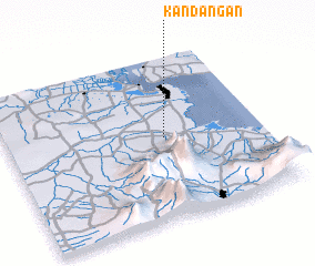 Places with similar names to Kandangan, Indonesia ::
// Canatongan (PH)
// Cantaongon (PH)
// Guinadiongan (PH)
// Guintungan (PH)
// Kandingan (PH)
// Kandangan (MY)
// Quintonkon (US)
// Gantungan (ID)
// Kandangan (ID)
// Kandangan (ID)
Disclaimer :: Information on this page comes without warranty of any kind |
||
|
Where is Kandangan? Elevation and coordinates ::
Latitude (lat): 7°30'0"S Longitude (lon): 112°37'0"E
Elevation (approx.): 11m (map arrows pan, magnifying glasses zoom) |
||
|
Visiting Kandangan? Hotel/Accommodation ::
Book a hotel in Kandangan Travel Guide ::
Buy a travel guide for Indonesia rental cars ::
car rental offers GPS waypoint ::
download a GPX waypoint (PoI) of Kandangan for your GPS receiver
|
||