|
search place name
|
||
Kandangsampi (Indonesia)Kandangsampi is a town in Indonesia. An overview map of the region around Kandangsampi is displayed below.
regional and 3d topo map of Kandangsampi, Indonesia ::

Kandangsampi airports ::
The nearest airport is CGK - Jakarta Soekarno Hatta Intl, located 32.9 km west of Kandangsampi.
Nearby towns ::
Kandangsapi (0.6km south west) //
Rorotan (0.9km east) //
Malaka Tiga (1.4km north east) //
Rawarengas (1.5km south east) //
Tambunrawarengas (2.0km south east) //
Kampungbaru (2.2km west) //
Sukapuraponcol (2.3km west) //
Utan (2.4km south) //
Karangtengah (2.4km north east) //
Kayutinggi (2.8km south) //
Sungaikendal (2.9km north east) //
Tambun-lobangbuaja (2.9km east) //
Gempol Satu (3.0km south) //
Sukapura (3.0km west) //
Sarangbango (3.1km north) //
Cakung (3.5km south west) //
Pulokendal (3.6km east) //
Kajangan (3.7km north west) //
Hutanhawit (3.7km south east) //
Rawagatel (3.8km north west) //
Kandang (3.8km north west) //
Buaran (3.9km south) //
Rawamalang (3.9km north west) //
Ujungmenteng Satu (3.9km south east) //
Rengas (4.1km north west) //
Kondangbesar (4.1km south) //
Sungaibambu (4.2km north east) //
Pedungan (4.3km south west) //
Cikedung (4.3km north east) //
[all distances 'as the bird flies' and approximate] 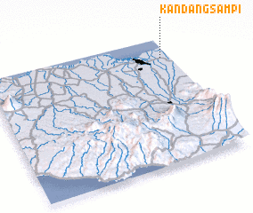 Places with similar names to Kandangsampi, Indonesia ::
// Kandangsampi (ID)
// Kandangsampi (ID)
Disclaimer :: Information on this page comes without warranty of any kind |
||
|
Where is Kandangsampi? Elevation and coordinates ::
Latitude (lat): 6°9'22"S Longitude (lon): 106°57'6"E
Elevation (approx.): 1m (map arrows pan, magnifying glasses zoom) |
||
|
Visiting Kandangsampi? Hotel/Accommodation ::
Book a hotel in Kandangsampi Travel Guide ::
Buy a travel guide for Indonesia rental cars ::
car rental offers GPS waypoint ::
download a GPX waypoint (PoI) of Kandangsampi for your GPS receiver
|
||