|
search place name
|
||
Leatung (Indonesia)Leatung is a town in Indonesia. An overview map of the region around Leatung is displayed below.
regional and 3d topo map of Leatung, Indonesia ::

Leatung airports ::
The nearest airport is PSJ - Poso Kasiguncu, located 201.9 km north east of Leatung.
Other airports nearby include UPG - Ujung Pandang Hasanuddin (222.4 km south), Nearby towns ::
Pasang (2.4km south west) //
Kapa (2.8km north east) //
Rangkaian (5.0km south west) //
Batau (5.1km north east) //
Rantebua (5.2km south east) //
Mendetek (5.3km west) //
Kambutu (5.6km east) //
Buka (6.3km north east) //
Buntulepong (6.4km east) //
Pararra (6.4km south) //
Lemo (6.8km north west) //
Makale (7.2km west) //
Botang (7.4km south west) //
Kandeupi (7.6km south) //
Simbole (7.7km west) //
Lengke (7.8km west) //
Bungin (8.1km west) //
Batualu (8.3km south east) //
Randanan (8.3km south west) //
Pasanglambe (8.4km north) //
Sipate (9.3km north east) //
Bokin (9.5km north east) //
Bua (9.9km north west) //
[all distances 'as the bird flies' and approximate] 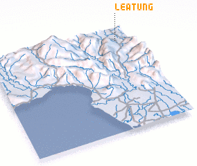 Places with similar names to Leatung, Indonesia ::
Disclaimer :: Information on this page comes without warranty of any kind |
||
|
Where is Leatung? Elevation and coordinates ::
Latitude (lat): 3°5'0"S Longitude (lon): 119°55'0"E
Elevation (approx.): 782m (map arrows pan, magnifying glasses zoom) |
||
|
Visiting Leatung? Hotel/Accommodation ::
Book a hotel in Leatung Travel Guide ::
Buy a travel guide for Indonesia rental cars ::
car rental offers GPS waypoint ::
download a GPX waypoint (PoI) of Leatung for your GPS receiver
|
||