|
search place name
|
||
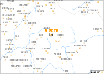
Sipate (Sulawesi Selatan, Indonesia)Sipate is a town in the Sulawesi Selatan region of Indonesia. An overview map of the region around Sipate is displayed below.
regional and 3d topo map of Sipate, Indonesia ::
Sipate airports ::
The nearest airport is PSJ - Poso Kasiguncu, located 194.1 km north of Sipate.
Nearby towns ::
Sendana (2.1km south east) //
Bengkudu (2.7km south east) //
Bokin (3.0km north west) //
Motok (3.1km east) //
Buka (3.9km west) //
Sepon (4.0km north east) //
Batau (5.5km west) //
Kambutu (5.6km south west) //
Buntulepong (6.0km south) //
Kapa (7.0km south west) //
Sumalu (7.3km south) //
Rante (7.8km south) //
Bonoran (8.4km north west) //
Pasanglambe (8.4km north west) //
Bonoran (8.5km north west) //
Penanian (8.5km north) //
Leatung (9.3km south west) //
Embang (9.4km north west) //
Libongkata (9.7km south east) //
Rantebua (9.7km south west) //
Pantilang (10.2km south east) //
Tede (10.3km south east) //
[all distances 'as the bird flies' and approximate] 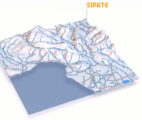 Places with similar names to Sipate, Indonesia ::
Disclaimer :: Information on this page comes without warranty of any kind |
||
|
Where is Sipate? Elevation and coordinates ::
Latitude (lat): 3°2'14"S Longitude (lon): 119°59'12"E
Elevation (approx.): 952m (map arrows pan, magnifying glasses zoom) |
||
|
Visiting Sipate? Hotel/Accommodation ::
Book a hotel in Sipate Travel Guide ::
Buy a travel guide for Indonesia rental cars ::
car rental offers GPS waypoint ::
download a GPX waypoint (PoI) of Sipate for your GPS receiver
|
||