|
search place name
|
||
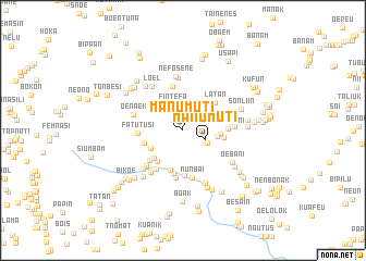
Manumuti (Nusa Tenggara Timur, Indonesia)Manumuti is a town in the Nusa Tenggara Timur region of Indonesia. An overview map of the region around Manumuti is displayed below.
regional and 3d topo map of Manumuti, Indonesia ::
Manumuti airports ::
The nearest airport is DIL - Dili Presidente Nicolau Lobato Intl, located 136.5 km north east of Manumuti.
Nearby towns ::
Kmulu (1.3km north) //
Manumuti (2.4km east) //
Fintefa (2.9km north) //
Tualeu (2.8km south east) //
Oeekam (3.3km north east) //
Maumabe (3.5km east) //
Naimnule (3.7km south west) //
Kolne (3.9km east) //
Obe (4.0km south west) //
Naikteas (4.1km south west) //
Konok (4.1km west) //
Kiun (4.2km east) //
Tanae (4.3km south) //
Latan (4.3km north east) //
Kiupasan (4.5km south) //
Nakal (4.6km south west) //
Oehalo (4.6km north) //
Fatutusi (4.6km west) //
Nunbai (4.7km south) //
Oesubani (4.6km east) //
Balkeh (4.8km south west) //
Kiumanuhain (4.9km south) //
Nunbai (4.9km south) //
Ap (5.0km east) //
Tainmetan (5.2km south west) //
Nunleu (5.2km east) //
Oenaek (5.2km west) //
Bibase (5.3km south west) //
Banmolo (5.5km north) //
[all distances 'as the bird flies' and approximate]  Places with similar names to Manumuti, Indonesia ::
// Mān Maw-wēt (MM)
// Mān Müt (MM)
// Mān Namhtū (MM)
// Mān Namta (MM)
// Mān Namtai (MM)
// Mān Namtao (MM)
// Mān Namte (MM)
// Manaomata (PH)
// Manambato (MG)
// Manambato (MG)
Disclaimer :: Information on this page comes without warranty of any kind |
||
|
Where is Manumuti? Elevation and coordinates ::
Latitude (lat): 9°23'15"S Longitude (lon): 124°37'0"E
Elevation (approx.): 429m (map arrows pan, magnifying glasses zoom) |
||
|
Visiting Manumuti? Hotel/Accommodation ::
Book a hotel in Manumuti Travel Guide ::
Buy a travel guide for Indonesia rental cars ::
car rental offers GPS waypoint ::
download a GPX waypoint (PoI) of Manumuti for your GPS receiver
|
||