|
search place name
|
||
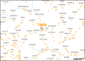
Tamis (Nusa Tenggara Timur, Indonesia)Tamis is a town in the Nusa Tenggara Timur region of Indonesia. An overview map of the region around Tamis is displayed below.
regional and 3d topo map of Tamis, Indonesia ::
Tamis airports ::
The nearest airport is DIL - Dili Presidente Nicolau Lobato Intl, located 137.3 km north east of Tamis.
Nearby towns ::
Fatuhau (0.3km west) //
Angket (0.7km north) //
Naekbesi (1.0km south west) //
Taunaes (1.1km east) //
Loel (1.8km east) //
Oenaek (2.8km south) //
Tonbesi (2.9km west) //
Uspupu (3.0km north) //
Usapibaki (3.6km north) //
Kunion (3.8km west) //
Oehalo (3.9km east) //
Aunimneko (4.1km north west) //
Fintefa (4.3km south east) //
Nefosene (4.4km east) //
Banmolo (4.5km east) //
Kuanik (4.7km north) //
Fatutusi (4.7km south) //
Nununae (4.9km north west) //
Nekleu (4.9km west) //
Kmulu (5.6km south east) //
Paesmoen (5.8km north) //
Bipaan (5.7km north west) //
Konok (5.8km south) //
Neono (5.7km west) //
Boentuna (6.3km north) //
Naimnule (6.5km south) //
Manumuti (6.6km south east) //
Tuntun (7.4km west) //
Haenfeka (7.4km north east) //
[all distances 'as the bird flies' and approximate] 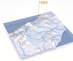 Places with similar names to Tamis, Indonesia ::
Disclaimer :: Information on this page comes without warranty of any kind |
||
|
Where is Tamis? Elevation and coordinates ::
Latitude (lat): 9°20'52"S Longitude (lon): 124°34'18"E
Elevation (approx.): 589m (map arrows pan, magnifying glasses zoom) |
||
|
Visiting Tamis? Hotel/Accommodation ::
Book a hotel in Tamis Travel Guide ::
Buy a travel guide for Indonesia rental cars ::
car rental offers GPS waypoint ::
download a GPX waypoint (PoI) of Tamis for your GPS receiver
|
||