|
search place name
|
||
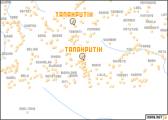
Tanahputih (Nusa Tenggara Timur, Indonesia)Tanahputih is a town in the Nusa Tenggara Timur region of Indonesia. An overview map of the region around Tanahputih is displayed below.
regional and 3d topo map of Tanahputih, Indonesia ::
Tanahputih airports ::
The nearest airport is DIL - Dili Presidente Nicolau Lobato Intl, located 151.8 km north east of Tanahputih.
Nearby towns ::
Pakdaging (0.2km north east) //
Kefamenanu (0.3km south west) //
Sabu (0.5km west) //
Tunbakun (0.6km south) //
Bansone (0.7km south west) //
Fatuteke (0.9km south) //
Kenari (0.9km south west) //
Kampungbaru (0.9km north) //
Patimura (1.0km north) //
Kelapatiga (1.1km west) //
Nunpene (1.2km south west) //
Pebobko (1.5km north) //
Ainjani (1.5km south) //
Aplasi (1.7km north) //
Leob (1.7km south) //
Benpasi (1.7km south west) //
Tanaputih (1.8km south) //
Seroja (2.0km north) //
Koko (2.0km south west) //
Airbak (2.1km north) //
Kilotiga (2.2km south) //
Nasileu (2.2km south) //
Faub (2.7km south) //
Maskole (2.7km west) //
Nefomtasa (2.9km south east) //
Oemanu (2.9km south) //
Kiloempat (3.0km south) //
Sontoi (3.0km west) //
Maumolo (3.1km south west) //
[all distances 'as the bird flies' and approximate] 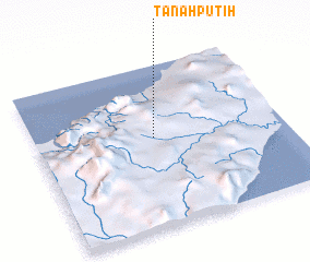 Places with similar names to Tanahputih, Indonesia ::
// Dinapit (PH)
// Tanah Puteh (MY)
// Tanah Puteh (MY)
// Tanah Putih (MY)
// Taniapéta (BJ)
// Tanippādi (IN)
// Tanahputih (ID)
// Tanahputih (ID)
// Tanahputih (ID)
// Tanaputih (ID)
Disclaimer :: Information on this page comes without warranty of any kind |
||
|
Where is Tanahputih? Elevation and coordinates ::
Latitude (lat): 9°26'40"S Longitude (lon): 124°28'49"E
Elevation (approx.): 428m (map arrows pan, magnifying glasses zoom) |
||
|
Visiting Tanahputih? Hotel/Accommodation ::
Book a hotel in Tanahputih Travel Guide ::
Buy a travel guide for Indonesia rental cars ::
car rental offers GPS waypoint ::
download a GPX waypoint (PoI) of Tanahputih for your GPS receiver
|
||