|
search place name
|
||
Mičak (Macedonia, The Republic of)Mičak is a town in Macedonia, The Republic of. An overview map of the region around Mičak is displayed below.
regional and 3d topo map of Mičak, Macedonia, The Republic of ::

Mičak airports ::
The nearest airport is SKP - Skopje, located 71.4 km west of Mičak.
Other airports nearby include SOF - Sofia (132.2 km north east), SKG - Thessaloniki Makedonia (143.9 km south), PRN - Pristina (147.3 km north west), OHD - Ohrid (154.8 km south west), Nearby towns ::
Vrteška (1.6km north west) //
Šipkovica (2.5km east) //
Prnalija (3.5km west) //
Kozbunar (4.1km south east) //
Kučica (4.4km west) //
Kodžalija (6.8km south) //
Počivalo (6.5km south west) //
Ali Lobasi (7.1km south east) //
Supurge (8.2km south) //
Šturovo (8.6km south east) //
Pripečani (8.0km north west) //
Kalauzlija (10.2km south east) //
Držanci (10.7km south east) //
[all distances 'as the bird flies' and approximate] 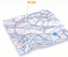 Places with similar names to Mičak, Macedonia, The Republic of ::
Disclaimer :: Information on this page comes without warranty of any kind |
||
|
Where is Mičak? Elevation and coordinates ::
Latitude (lat): 41°45'0"N Longitude (lon): 22°26'0"E
Elevation (approx.): 1168m (map arrows pan, magnifying glasses zoom) |
||
|
Visiting Mičak? Hotel/Accommodation ::
Book a hotel in Mičak Travel Guide ::
rental cars ::
car rental offers GPS waypoint ::
download a GPX waypoint (PoI) of Mičak for your GPS receiver
|
||