|
search place name
|
||
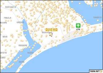
Avema (Volta, Ghana)Avema is a town in the Volta region of Ghana. An overview map of the region around Avema is displayed below.
regional and 3d topo map of Avema, Ghana ::
Avema airports ::
The nearest airport is LFW - Lome Gnassingbe Eyadema Intl, located 10.5 km east of Avema.
Other airports nearby include COO - Cotonou Cadjehoun (137.1 km east), ACC - Accra Kotoka Intl (158.6 km west), Nearby towns ::
Flagbo (0.3km north) //
Zogbe (0.6km north) //
Ablekpui (1.0km north west) //
Ato (1.5km south) //
Musakope (1.7km east) //
Okokima (1.8km west) //
Gamadzra (2.0km west) //
Avome (2.1km south) //
Bugbala (2.2km north) //
Agoli (2.2km north) //
Avoeme Kpotame (2.4km south east) //
Ziome (2.4km north) //
Avakorme (2.6km south) //
Sodzisikope (2.7km south east) //
Viepe (2.8km south) //
Viefegula (2.8km north west) //
Tama (2.9km north east) //
Aflao (3.2km south east) //
Akporkploe (3.3km north) //
Ataglokope (3.5km south) //
Kpanu (3.6km north west) //
Blagpadu (3.7km west) //
Klukpe (3.7km west) //
Gblefedo (3.7km west) //
Kudaokofe (3.9km south east) //
Danome (4.0km west) //
Agoveme (4.0km west) //
Duta (4.0km north east) //
Haglakofe (4.0km south west) //
[all distances 'as the bird flies' and approximate]  Places with similar names to Avema, Ghana ::
Disclaimer :: Information on this page comes without warranty of any kind |
||
|
Where is Avema? Elevation and coordinates ::
Latitude (lat): 6°7'49"N Longitude (lon): 1°9'59"E
Elevation (approx.): 11m (map arrows pan, magnifying glasses zoom) |
||
|
Visiting Avema? Hotel/Accommodation ::
Book a hotel in Avema Travel Guide ::
Buy a travel guide for Ghana rental cars ::
car rental offers GPS waypoint ::
download a GPX waypoint (PoI) of Avema for your GPS receiver
|
||