|
search place name
|
||
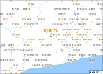
Edumtu (Ghana)Edumtu is a town in Ghana. An overview map of the region around Edumtu is displayed below.
regional and 3d topo map of Edumtu, Ghana ::
Edumtu airports ::
The nearest airport is TKD - Takoradi, located 37.5 km south west of Edumtu.
Other airports nearby include ACC - Accra Kotoka Intl (160.2 km east), Nearby towns ::
Mpehin (1.8km east) //
Anyoum (2.6km north west) //
Besiasi (4.1km south east) //
Akatebura (4.1km south west) //
Abukrom (4.1km north east) //
Samani (4.1km south west) //
Abrawdiwurem (4.1km north west) //
Sefwi (5.2km south west) //
Odumasi (5.5km east) //
Echiasi (5.9km south) //
Anteado (5.9km south) //
Warababa (5.8km east) //
Nsuyena (6.7km north east) //
Ansiemua (6.7km south west) //
Kukuadu (6.7km south east) //
Kisi (6.7km south east) //
Hemang (6.7km north west) //
Jerusalem (6.7km north east) //
Amawafur (7.4km east) //
Abransa (7.4km south) //
Dominasi (7.6km south) //
Nkrang (7.6km west) //
Abakanu (8.3km south east) //
Atechem (8.3km north east) //
Nyamibechere (8.3km north west) //
Esiako (9.2km north east) //
Fawumaye (9.3km south west) //
Mandu (10.5km south east) //
Nsagwir (10.5km south east) //
[all distances 'as the bird flies' and approximate] 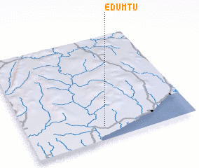
Disclaimer :: Information on this page comes without warranty of any kind |
||
|
Where is Edumtu? Elevation and coordinates ::
Latitude (lat): 5°8'0"N Longitude (lon): 1°32'0"W
Elevation (approx.): 53m (map arrows pan, magnifying glasses zoom) |
||
|
Visiting Edumtu? Hotel/Accommodation ::
Book a hotel in Edumtu Travel Guide ::
Buy a travel guide for Ghana rental cars ::
car rental offers GPS waypoint ::
download a GPX waypoint (PoI) of Edumtu for your GPS receiver
|
||