|
search place name
|
||
Cieneguillas (Hidalgo, Mexico)Cieneguillas is a town in the Hidalgo region of Mexico. An overview map of the region around Cieneguillas is displayed below.
regional and 3d topo map of Cieneguillas, Mexico ::

Cieneguillas airports ::
The nearest airport is PCA - Pachuca Ingeniero Juan Guillermo Villasana, located 29.6 km south west of Cieneguillas.
Other airports nearby include TXA - Tlaxcala (98.3 km south east), MEX - Mexico City Licenciado Benito Juarez Intl (106.6 km south west), PAZ - Poza Rico Tajin (127.3 km east), PBC - Puebla Hermanos Serdan Intl (130.4 km south), Nearby towns ::
Los Sabinos (1.5km north west) //
Apipilhuasco (2.9km north) //
La Puebla (3.0km south west) //
La Cantera (3.2km north east) //
Atotonilco el Grande (3.9km south west) //
Potrero de los Reyes (3.9km east) //
Santa Catarina (4.3km north) //
El Ocote (4.3km north east) //
La Cruz (4.7km south) //
Tezahuapa (4.7km south) //
San Miguel (4.6km south west) //
Tiltepec (4.6km west) //
Montecillos (5.0km south east) //
Los Reyes (5.2km north east) //
Los Cerritos (5.9km south east) //
Agua Limpia (6.5km south) //
San Martín (6.6km north) //
Ojo de Agua (6.7km south east) //
La Cañada (6.6km south east) //
Lagunilla (6.8km north west) //
Santo Tomás (7.7km south east) //
Los Sabinos (7.9km north) //
San José (7.8km north west) //
Venta de Guadalupe (8.7km south) //
El Cortadero (8.9km north west) //
Santiaguillo (9.0km south west) //
Uña de Gato (8.9km north east) //
El Paraje de los Sauces (9.5km north east) //
Regla (10.1km south east) //
[all distances 'as the bird flies' and approximate] 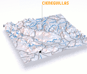 Places with similar names to Cieneguillas, Mexico ::
// Zünqülǝş (AZ)
// Singlis (DE)
// Cengles (IT)
// San Nicolas (IT)
// San Nicolás (CU)
// San Nicolás (CU)
// San Nicolás (CU)
// San Nicolás (CU)
// San Nicolás (CU)
// San Nicolás (CU)
Disclaimer :: Information on this page comes without warranty of any kind |
||
|
Where is Cieneguillas? Elevation and coordinates ::
Latitude (lat): 20°18'30"N Longitude (lon): 98°38'25"W
Elevation (approx.): 1991m (map arrows pan, magnifying glasses zoom) |
||
|
Visiting Cieneguillas? Hotel/Accommodation ::
Book a hotel in Cieneguillas Travel Guide ::
Buy a travel guide for Mexico rental cars ::
car rental offers GPS waypoint ::
download a GPX waypoint (PoI) of Cieneguillas for your GPS receiver
|
||