|
search place name
|
||
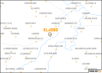
El Jobo (Veracruz-Llave, Mexico)El Jobo is a town in the Veracruz-Llave region of Mexico. An overview map of the region around El Jobo is displayed below.
regional and 3d topo map of El Jobo, Mexico ::
El Jobo airports ::
The nearest airport is PAZ - Poza Rico Tajin, located 52.8 km south east of El Jobo.
Other airports nearby include PCA - Pachuca Ingeniero Juan Guillermo Villasana (128.2 km south west), TXA - Tlaxcala (150.2 km south), TAM - Tampico General Francisco Javier Mina Intl (158.3 km north), TSL - Tamuin (161.2 km north west), Nearby towns ::
Vinasco (4.1km north east) //
Ursulo Galván (4.9km south) //
La Mesa (5.2km west) //
Naranjo Dulce (5.5km west) //
Cuicuinaco (6.6km north east) //
El Alambique (7.4km south) //
La Avanzada (7.6km north) //
El Aguacate (7.2km east) //
Sombrerete (7.9km north east) //
Camotipan (7.9km north west) //
Tlachiquil (9.1km north west) //
Lechecuatitla (8.9km south west) //
[all distances 'as the bird flies' and approximate] 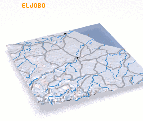 Places with similar names to El Jobo, Mexico ::
Disclaimer :: Information on this page comes without warranty of any kind |
||
|
Where is El Jobo? Elevation and coordinates ::
Latitude (lat): 20°52'0"N Longitude (lon): 97°53'0"W
Elevation (approx.): 93m (map arrows pan, magnifying glasses zoom) |
||
|
Visiting El Jobo? Hotel/Accommodation ::
Book a hotel in El Jobo Travel Guide ::
Buy a travel guide for Mexico rental cars ::
car rental offers GPS waypoint ::
download a GPX waypoint (PoI) of El Jobo for your GPS receiver
|
||