|
search place name
|
||
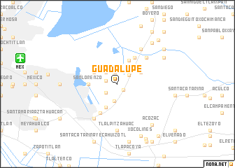
Guadalupe (México, Mexico)Guadalupe is a town in the México region of Mexico. An overview map of the region around Guadalupe is displayed below.
regional and 3d topo map of Guadalupe, Mexico ::
Guadalupe airports ::
The nearest airport is MEX - Mexico City Licenciado Benito Juarez Intl, located 15.1 km west of Guadalupe.
Other airports nearby include PBC - Puebla Hermanos Serdan Intl (64.8 km south east), TLC - Toluca Licenciado Adolfo Lopez Mateos Intl (66.8 km west), CVJ - Cuernavaca General Mariano Matamoros (71.5 km south west), PCA - Pachuca Ingeniero Juan Guillermo Villasana (76.6 km north), Nearby towns ::
El Portezuelo (1.3km south east) //
Santa María Nativitas (1.9km north) //
San Sebastián Chimalpa (1.8km west) //
San José (2.2km north east) //
San Agustín Atlapulco (2.2km south west) //
Xochitenco (2.5km north west) //
La Loma (2.8km south) //
Los Laureles (4.1km north east) //
Chicoloapan de Juárez (4.0km north east) //
Santa María Chimalhuacán (4.0km north east) //
Santiago Cuautlalpan (4.0km north east) //
La Magdalena Atlipac (4.1km south west) //
Xochiaca (4.0km north west) //
San Lorenzo (4.4km west) //
El Tejocote (4.9km north east) //
Tecamachalco (5.3km south west) //
El Mexcatillo (6.0km north east) //
San Bernardino (6.6km north east) //
Montecillo (6.6km north east) //
Los Reyes (6.6km south west) //
Tlalpitzahuac (7.4km south) //
Tepetitlán (8.1km north east) //
Acozac (8.3km south east) //
Santa Rosa (8.3km north east) //
Xocolines (9.0km south east) //
San Miguel Coatlinchán (8.9km north east) //
Lomas de San Esteban (9.3km north east) //
La Magdalena (9.8km south east) //
La Via Lactea (9.9km north east) //
[all distances 'as the bird flies' and approximate]  Places with similar names to Guadalupe, Mexico ::
Disclaimer :: Information on this page comes without warranty of any kind |
||
|
Where is Guadalupe? Elevation and coordinates ::
Latitude (lat): 19°24'0"N Longitude (lon): 98°56'0"W
Elevation (approx.): 2247m (map arrows pan, magnifying glasses zoom) |
||
|
Visiting Guadalupe? Hotel/Accommodation ::
Book a hotel in Guadalupe Travel Guide ::
Buy a travel guide for Mexico rental cars ::
car rental offers GPS waypoint ::
download a GPX waypoint (PoI) of Guadalupe for your GPS receiver
|
||